Kentucky and Indiana Bridge (Louisville-Jefferson County, Kentucky)
USA /
Indiana /
New Albany /
Louisville-Jefferson County, Kentucky
World
/ USA
/ Indiana
/ New Albany
World / United States / Kentucky
truss bridge, railway bridge
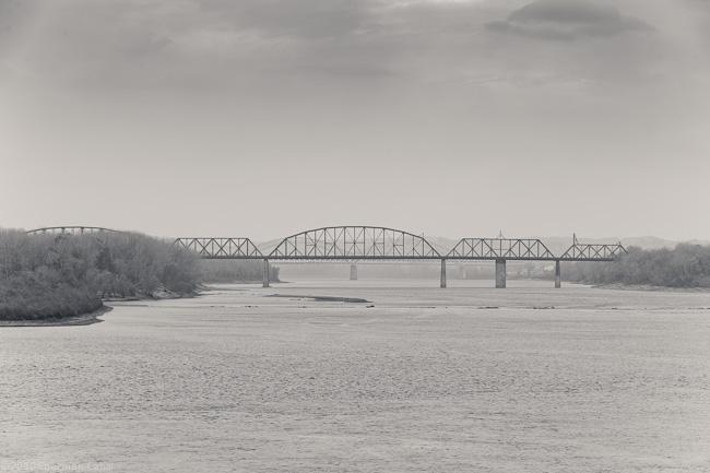

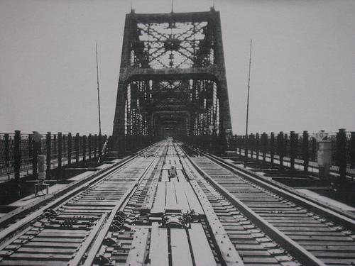

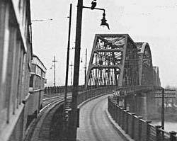
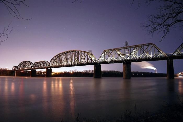
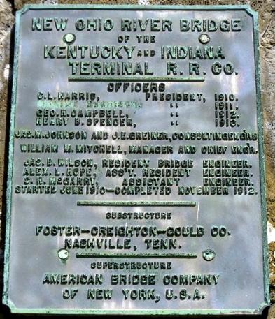
Through truss railroad bridge erected between 1910 and 1912. The existing Kentucky and Indiana Bridge replaced an earlier span that opened in 1886. Built primarily to carry railroad and local interurban traffic between New Albany and Louisville, the K&I was one of the largest and heaviest plain truss bridges in the world at the time it was completed. The complete span, including approaches, measured nearly 6,000 feet in length and 225 feet in height from its highest point to the normal river surface. The bridge’s 70-foot width originally included two pairs of railroad lines flanked by wagon ways paved with creosoted wooden blocks. These blocks handled automobile traffic until 1952, when they were replaced with a steel gridwork. The K&I accommodated vehicular traffic until early 1979, when a road bed partially collapsed under the weight of an overloaded gravel truck. It continues to carry railroad traffic.
Struck by an asphalt barge in 2006. No damage incurred.
There are plans to convert the automobile lanes into pedestrian and bicycle lanes in the future.
Struck by an asphalt barge in 2006. No damage incurred.
There are plans to convert the automobile lanes into pedestrian and bicycle lanes in the future.
Wikipedia article: http://en.wikipedia.org/wiki/Kentucky_&_Indiana_Terminal_Bridge
Nearby cities:
Coordinates: 38°16'58"N 85°48'4"W
- Falls of the Ohio Railroad Bridge 2.7 km
- CSX Railroad Bridge 165 km
- Metropolis Railroad Bridge 288 km
- US 36 (IL 121) bridge over Lake Decatur 320 km
- Point Pleasant Rail Bridge 324 km
- Speers Railroad Bridge 550 km
- Ohio Connecting Railroad Bridge 552 km
- Panhandle Bridge 554 km
- Railway Bridge 701 km
- Site of SAL Railway Broad River bridge (abandoned) 783 km
- Ohio River Greenway 1.7 km
- Portland neighborhood 1.8 km
- Louisville and Portland Canal 2.2 km
- Shippingport Island 2.2 km
- Shawnee neighborhood 2.7 km
- West End 3.2 km
- Lapping Park 6.7 km
- Floyds Knobs, Indiana 7.6 km
- Floyd County, Indiana 8.5 km
- Clark County, Indiana 19 km