NMCP Building 215 (Portsmouth, Virginia)
USA /
Virginia /
Portsmouth /
Portsmouth, Virginia
World
/ USA
/ Virginia
/ Portsmouth
World / United States / Virginia
hospital, United States Navy
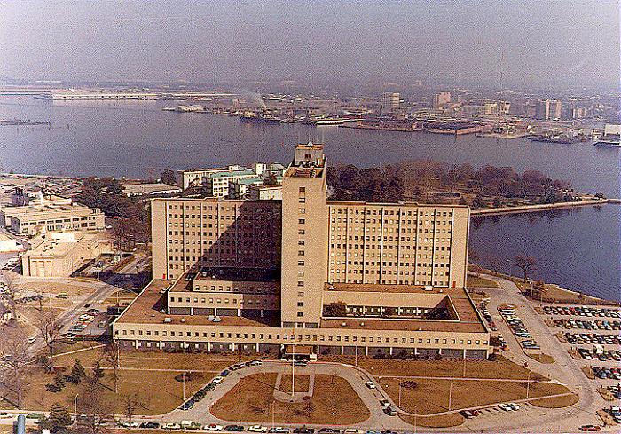
Construction for Building 215, the high-rise most people associate with Naval Medical Center Portsmouth, began in 1957 and was completed in 1960.
Wikipedia article: http://en.wikipedia.org/wiki/Naval_Medical_Center_Portsmouth
Nearby cities:
Coordinates: 36°50'38"N 76°18'17"W
- Dare Bombing Range 125 km
- Naval Air Station Patuxent River (NHK/KNHK) 164 km
- Naval Surface Warfare Center - Dahlgren Division (NSWCDD) 182 km
- Military Ocean Terminal Sunny Point 349 km
- Naval Air Engineering Station - Lakehurst 392 km
- Naval Weapons Station Charleston 543 km
- Wreck of USS America (CV-66) 583 km
- Naval Submarine Base Kings Bay 827 km
- Naval Air Station Meridian 1221 km
- Guantanamo Bay Naval Base 1881 km
- Downtown Norfolk 1.7 km
- Portsmouth Marine Terminals 1.9 km
- Ghent 2.4 km
- West Ghent 2.7 km
- Norfolk Southern Lambert's Point Coal Terminal 3.3 km
- Park Place 3.6 km
- Old Dominion University 4.6 km
- South Norfolk 5.4 km
- Virginia International Gateway (VIG) 6 km
- Washington 12 km
Comments