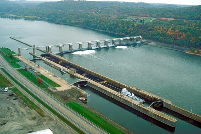
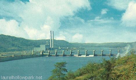
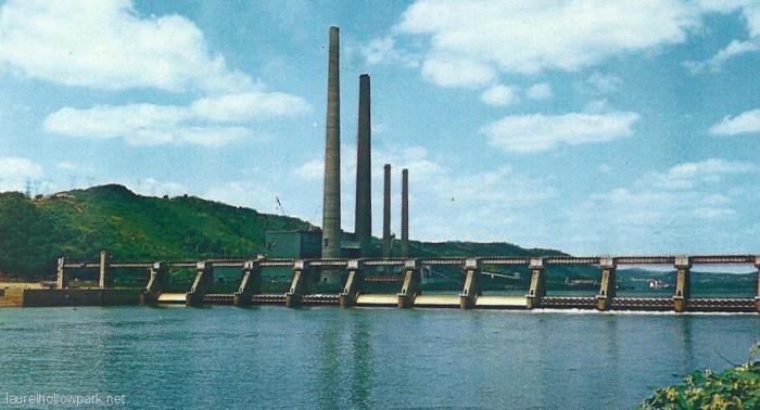
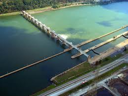
New Cumberland Locks and Dam
USA /
Ohio /
Stratton /
World
/ USA
/ Ohio
/ Stratton
World / United States / Ohio
dam, lock (water navigation)

www.lrp.usace.army.mil/nav/nc.htm
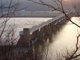
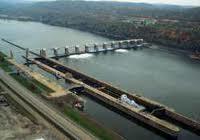
New Cumberland Locks and Dam is located on the right descending bank of the Ohio River, just off Ohio State Route 7 at the small town of Stratton, Ohio.
New Cumberland Locks and Dam is located on the right descending bank of the Ohio River, just off Ohio State Route 7 at the small town of Stratton, Ohio.
Nearby cities:
Coordinates: 40°31'33"N 80°37'34"W
- Sutton Dam and reservoir 207 km
- J.E. Roush Fish and Wildlife Area 412 km
- McAlpine Dam 509 km
- Dreher Shoals Dam 721 km
- Dam Number 10 762 km
- Barkley Dam 765 km
- Kentucky Dam 771 km
- TVA Pickwick Landing Dam 904 km
- Sardis Dam 1057 km
- Grenada Lake Dam 1100 km
- Village of Stratton (Ohio) 0.4 km
- Hancock County, West Virginia 3 km
- Tomlinson Run State Park 3.7 km
- First Energy Rock Hollow Landfill 4.2 km
- ArcelorMittal Weirton Steel 12 km
- Hanover Township 16 km
- Greene Township 16 km
- Hanover Township 20 km
- Beaver County, Pennsylvania 29 km
- Washington County, Pennsylvania 51 km