Indiana County - Jimmy Stewart Airport (KIDI)
USA /
Pennsylvania /
Chevy Chase Heights /
Airport Road, 398
World
/ USA
/ Pennsylvania
/ Chevy Chase Heights
World / United States / Pennsylvania
airport, municipal
Airport Identifier: IDI
Elevation: 1405 ft / 428.24 m (Surveyed)
Land: 276 acres
From nearest city: 2 nautical miles E of Indiana, PA
Location: Indiana County, PA
Magnetic Variation: 08W (1985)
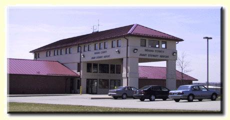
Indiana County-Jimmy Stewart Airport (IATA: IDI, ICAO: KIDI, FAA LID: IDI), also referred to as Indiana County Airport or Jimmy Stewart Field, is a county-owned public-use airport located two miles (3 km) east of the borough of Indiana, in Indiana County, Pennsylvania, United States.[1] The airport is approximately 65 miles (105 km) northeast of Pittsburgh. It is classified as a business service airport by the Pennsylvania Bureau of Aviation.
www.jimmystewartairport.com/
www.dot.state.pa.us/Internet/Bureaus/pdBOA.nsf/infoIndi...
www.airport-data.com/airport/IDI/
www.globalair.com/airport/airport.aspx?aptcode=KIDI
Elevation: 1405 ft / 428.24 m (Surveyed)
Land: 276 acres
From nearest city: 2 nautical miles E of Indiana, PA
Location: Indiana County, PA
Magnetic Variation: 08W (1985)
Indiana County-Jimmy Stewart Airport (IATA: IDI, ICAO: KIDI, FAA LID: IDI), also referred to as Indiana County Airport or Jimmy Stewart Field, is a county-owned public-use airport located two miles (3 km) east of the borough of Indiana, in Indiana County, Pennsylvania, United States.[1] The airport is approximately 65 miles (105 km) northeast of Pittsburgh. It is classified as a business service airport by the Pennsylvania Bureau of Aviation.
www.jimmystewartairport.com/
www.dot.state.pa.us/Internet/Bureaus/pdBOA.nsf/infoIndi...
www.airport-data.com/airport/IDI/
www.globalair.com/airport/airport.aspx?aptcode=KIDI
Wikipedia article: http://en.wikipedia.org/wiki/Indiana_County-Jimmy_Stewart_Airport
Nearby cities:
Coordinates: 40°37'56"N 79°6'24"W
- Pittsburgh International Airport - (PIT) 100 km
- Wheeling - Ohio County Airport (HLG) 141 km
- Akron–Canton Airport (CAK/KCAK) 202 km
- Mansfield Lahm Airport (MFD/KMFD) 290 km
- John Glenn Columbus International Airport (CMH/KCMH) 330 km
- Rickenbacker International Airport - (LCK / KLCK) 340 km
- Springfield-Beckley Municipal Airport (SGH/KSGH) 413 km
- Airborne Airpark (ILN/KILN) 423 km
- Wright Patterson Air Force Base (FFO/KFFO) 435 km
- Dayton International Airport (DAY/KDAY) 444 km
- Indiana County, Pennsylvania 2.1 km
- White Township 4.4 km
- Rayne Township 8.3 km
- Center Township 11 km
- Brush Valley Township 12 km
- Washington Township 12 km
- Armstrong Township 15 km
- Plumcreek Township 21 km
- Armstrong County, Pennsylvania 38 km
- Westmoreland County, Pennsylvania 41 km