Tâmpa mountain
Romania /
Brasov /
World
/ Romania
/ Brasov
/ Brasov
World / Romania
mountain, green area


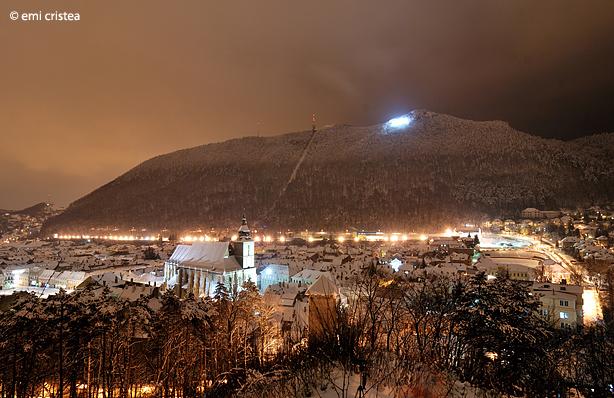
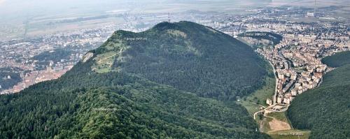
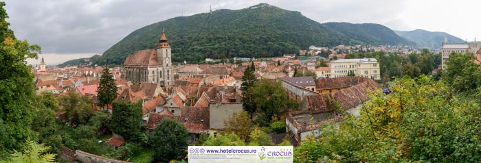
Tâmpa is a mountain, part of the Postăvaru Massif, located in the southern part of the Eastern Carpathians (more precisely in the Curved Carpathians) and almost entirely surrounded by the city of Braşov. Its elevation is 960 m (995 m according to some sources), almost 400 m above the city.
Legenda muntelui Tampa: geografilia.blogspot.com/2010/11/legende-populare-geogr...
Legenda muntelui Tampa: geografilia.blogspot.com/2010/11/legende-populare-geogr...
Wikipedia article: http://en.wikipedia.org/wiki/Tâmpa,_Braşov
Nearby cities:
Coordinates: 45°38'3"N 25°35'42"E
- Baiului Mountains (Gârbova Mountains) 5.8 km
- Vrancea Mountains 78 km
- Bodoc Mountains 81 km
- Nemira Mountains 94 km
- Harghita Mountains 109 km
- Ciuc Mountains 109 km
- Berzunţi Mountains 121 km
- Tarcău Mountains (1664 m) 144 km
- Hăşmaş Mountains 149 km
- Giurgeu Mountains 152 km
- " Brassovia " Citadel 0.3 km
- The Medieval City of Brasov (the walled city Korona/Kronstadt) 0.8 km
- Valea Cetăţii neighbourhood 1 km
- Revolution Square 1.2 km
- Braşov 1.3 km
- Forest 1.3 km
- "Holy Trinity" Cemetery 1.5 km
- Schei & Prund neighbourhoods 1.6 km
- Forest 2.7 km
- Brașov County 24 km
Comments