CP-WEST PITT (removed) (Pittsburgh, Pennsylvania)
USA /
Pennsylvania /
Pittsburgh /
Pittsburgh, Pennsylvania
World
/ USA
/ Pennsylvania
/ Pittsburgh
World / United States / Pennsylvania
railway, interlocking


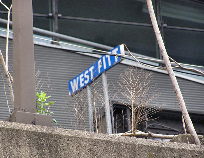
Former interlocking on the PRR Main Line / Conrail Pittsburgh Line this marked the terminus of the original "Lines East" segment of the PRR Main Line at 353 miles from the end of the platform at Broad Street Station in Philadelphia.
CP-WEST PITT was the west end of the short controlled siding / third through track in Penn Station Pittsburgh. All movements through CP-WEST PITT were restricted to SLOW speed (15mph).
CP-WEST PITT was the west end of the short controlled siding / third through track in Penn Station Pittsburgh. All movements through CP-WEST PITT were restricted to SLOW speed (15mph).
Nearby cities:
Coordinates: 40°26'44"N 79°59'37"W
- Conway Yard 36 km
- Former alignment of the PRR (Pre-1957) 53 km
- Original PRR alignment pre-1899 53 km
- South Pennsylvania Railroad Right of Way (Abandoned) 76 km
- South Pennsylvania Railroad Right of Way (Abandoned) 86 km
- B&O Berlin Branch (Abandoned) 97 km
- South Pennsylvania Railroad Right of Way (Abandoned) 100 km
- B&O/CSX Salisbury Branch (Partially Abandoned) 101 km
- Blue Lick Branch (Abandoned) 104 km
- South Pennsylvania Railroad Right Of Way (Abandoned) 110 km
- Golden Triangle 0.7 km
- Lower Hill Neighborhood 0.9 km
- North Shore 1 km
- Bluff Neighborhood 1.3 km
- Strip District Neighborhood 1.4 km
- Hill District 1.7 km
- Middle Hill Neighborhood 1.7 km
- South Shore Neighborhood 1.9 km
- Mt. Washington Neighborhood 2.5 km
- Southside Flats Neighborhood 3 km