Elliot West CSO Control Facility (Seattle, Washington)
USA /
Washington /
Seattle /
Seattle, Washington /
Elliott Avenue West, 645
World
/ USA
/ Washington
/ Seattle
World / United States / Washington
sewage pumping station
Add category
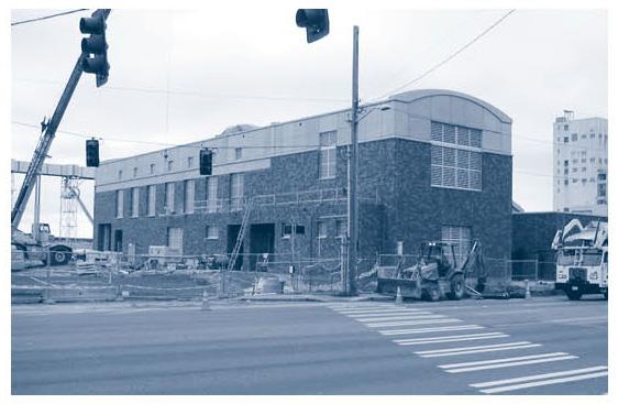
West side of tunnel running under Mercer Street. Used during heavy rain to keep from dumping raw sewer into Elliot Bay
Other end is here: wikimapia.org/11919211/East-Portal-Mercer-Street-Tunne...
www.kingcounty.gov/environment/wtd/Construction/Seattle...
Other end is here: wikimapia.org/11919211/East-Portal-Mercer-Street-Tunne...
www.kingcounty.gov/environment/wtd/Construction/Seattle...
Nearby cities:
Coordinates: 47°37'28"N 122°21'59"W
- Beatty Water & Sanitation District Public Water System (BWSD) Site 1279 km
- Mainline Pumping Station 2783 km
- WTUA Lower Rouge Pump Station 3089 km
- Connors Creek Pumping Station 3122 km
- WASA O Street Pumping Station 3747 km
- Shifnal Sewage Works 7512 km
- Oxford Littlemore Sewage Treatment Works 7643 km
- Fobney Water Treatment Works 7677 km
- Acton Sewage Storm Tanks 7703 km
- Hogsmill Sewage Treatment Works 7710 km
- Lower Queen Anne 0.9 km
- Elliott Bay 1.6 km
- Belltown 2 km
- Queen Anne 2 km
- South Lake Union 2.2 km
- Lake Union 3 km
- Magnolia 4.2 km
- Harbor Island 5.1 km
- Industrial District 6 km
- West Seattle 7.6 km