Harbor Island (Seattle, Washington)
USA /
Washington /
Seattle /
Seattle, Washington
World
/ USA
/ Washington
/ Seattle
World / United States / Washington
seaport, draw only border, environmental protection agency
Harbor Island - Port of Seattle
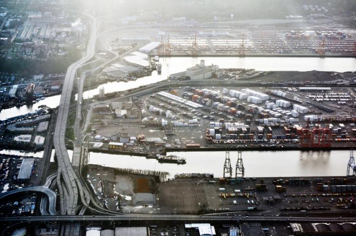
Harbor Island is the third largest manmade island in the world. Cargo ships used to dump their ballast in this swampy region when they came into port; the ballast built up over time to the point where the city decided to do something about it. They dredged out the Duwamish River into the East and West Waterways, which border Harbor Island. These waterways are now the home to many gantry cranes used in international commerce.
--------------------------------------------------------------------------
EPA Superfund site (lead):
Address: MOUTH OF DUWAMISH RIVERSEATTLE, WA 98134
Electronic Address: oaspub.epa.gov/cleanups/cleanup_master.identify?regId=1...
Program Name: Superfund
Program Acronym: CERCLA
Program ID: WAD980722839
Interest Type: SUPERFUND NPL
Full Name: The Comprehensive Environmental Response, Compensation, and Liability Act (CERCLA)
cfpub2.epa.gov/supercpad/cursites/csitinfo.cfm?id=10009...
------------------------------------------------------------------------
Wikipedia article: http://en.wikipedia.org/wiki/Harbor_Island_(Seattle)
Nearby cities:
Coordinates: 47°34'47"N 122°21'7"W
- Quarter-Master Harbor 22 km
- Port of Tacoma 33 km
- Los Angeles-Long Beach Port Complex 1573 km
- Port of Brownsville 3246 km
- Port of Altamira 3534 km
- Manzanillo 3559 km
- Ciudad del Carmen 4239 km
- Bahias de Huatulco 4274 km
- Salina Cruz 4284 km
- Pearl Harbor 4316 km
- Seattle Terminal 5 1 km
- Industrial District 1.6 km
- West Seattle 3.1 km
- Belltown 3.9 km
- Lower Queen Anne 4.7 km
- Elliott Bay 5.1 km
- South Lake Union 5.3 km
- Queen Anne 6.9 km
- Lake Union 6.9 km
- Magnolia 8.9 km