Bald Mountain Gold Mine - North Block
USA /
Nevada /
Spring Creek /
Long Valley Rd./State Hwy-3
World
/ USA
/ Nevada
/ Spring Creek
World / United States / Nevada
mine
Add category
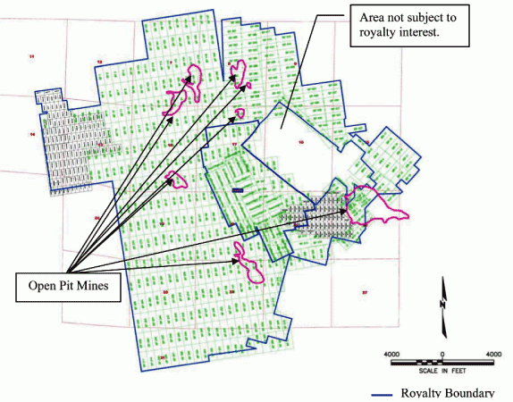
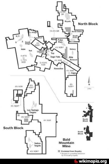
The Bald Mountain mine lies within the Southern Ruby Mountains of northeastern Nevada, approximately 110 kilometres southeast of Elko. Bald Mountain is operated by Barrick and ore is sourced from multiple open pits over an estimated 150,000 acre property. Processing is done at multiple conventional heap leaching facilities using carbon absorption for gold recovery. In February 2010, the Federal Bureau of Land Management (the “BLM”) approved a planned expansion designed to significantly increase production and extend the mine life at Bald Mountain.
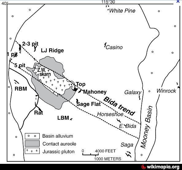
Mining has occurred in the Bald Mountain Area since the late 1800s. Minerals recovered include copper, antimony, silver, and gold. Most of the early mining occurred next to a small granitic intrusion south of Big Bald Mountain. Large-scale commercial gold mining began in the area in 1976 at the Alligator Ridge Mine. Previous and current mining operations have occurred in five areas resulting in 26 open pits, 30 rock disposal areas, 10 heap leach pads, and seven process ponds. Sedimentary rock in the Proposed Action area consists of Paleozoic limestone, dolomite, shale, quartzite, siltstone, and sandstone. These have been intruded by Mesozoic age granitic porphyry, which is directly associated with the districts wide alteration.
Reference:
www.barrick.com/GlobalOperations/NorthAmerica/BaldMount...
Nearby cities:
Coordinates: 39°56'24"N 115°32'39"W
- Mount Hope Project 59 km
- Gold Bar Mine Project Area 73 km
- Railroad Project 85 km
- Cortez Mine Operations Permit Area 113 km
- Phoenix Copper/Gold Project 155 km
- Pond system to Extract Potash & Magnesium Coloride from Salt Brine 156 km
- Marigold Mine Property Boundary 171 km
- Round Mountain Gold Mine 187 km
- Chemetal Foote Lithium Operations 297 km
- Clayton Valley Lithium Deposits 306 km
- Shantytown, Nevada 25 km
- Ruby Lake National Wildlife Refuge 26 km
- Rattlesnake Mountain 35 km
- Diamond Valley 38 km
- Green Mountain 51 km
- Tipton Peak 54 km
- Ruby Mountains 57 km
- Ruby Valley Indian Allotment 59 km
- Robinson Mountain 60 km
- Cedar Ridge Wilderness Study Area 62 km