St. Francis Dam Site
USA /
California /
Santa Clarita /
World
/ USA
/ California
/ Santa Clarita
World / United States / California
ruins, dam, disaster site


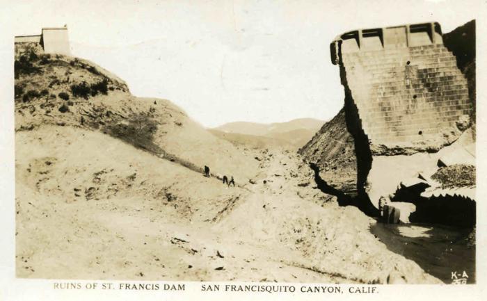
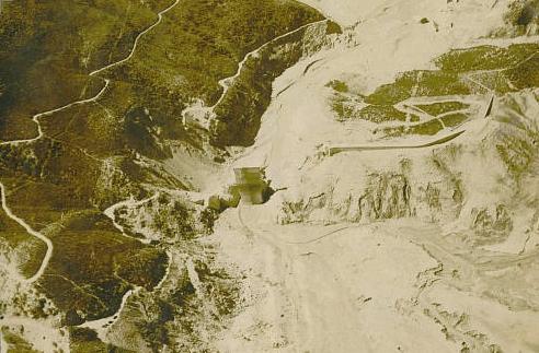
Constructed in 1926, and failed in 1928, the St. Francis Dam, formerly located here, killed between 400 to 500 people as floodwaters tore through San Francesquito canyon, the Santa Clarita valley, Fillmore, Santa Paula, and Ventura.
Pieces of the old dam can clearly be seen in this imagery here, and further downstream.
www.youtube.com/watch?v=BilO_Bv7pW0
Pieces of the old dam can clearly be seen in this imagery here, and further downstream.
www.youtube.com/watch?v=BilO_Bv7pW0
Wikipedia article: http://en.wikipedia.org/wiki/St._Francis_Dam_Disaster
Nearby cities:
Coordinates: 34°32'51"N 118°30'47"W
- Hansen Dam Recreational Area 32 km
- Lake Perris Dam 143 km
- Dam 280 km
- Hidden Dam 312 km
- San Luis Dam 365 km
- Cerro Prieto Lake 381 km
- Folsom Dam 522 km
- Painted Rock Dam 533 km
- Fremont Weir 547 km
- Oroville Dam 616 km
- Reservoir for the St. Francis Dam (Approximate Location) 1.4 km
- Castaic Lake 8.1 km
- Hidden Lake Neighborhood 12 km
- Peter J. Pitchess Detention Center (Sheriff's Wayside County Jail) 12 km
- Elderberry Forebay 12 km
- Five Mile Grade 13 km
- Castaic, California 13 km
- Valencia 15 km
- Val Verde, California 18 km
- Los Angeles County, California 37 km