Columbia Downtown (Jim Hamilton - L.B. Owens Field) Airport - KCUB (Columbia, South Carolina)
USA /
South Carolina /
Cayce /
Columbia, South Carolina /
Jim Hamilton Blvd., 1400
World
/ USA
/ South Carolina
/ Cayce
World / United States / South Carolina
airport, municipal
Airport Identifier: CUB
Elevation: 193 ft / 58.83 m (Surveyed)
Land: 182 acres
From nearest city: 2 nautical miles S of Columbia, SC
Location: Richland County, SC
Magnetic Variation: 06W (1995)
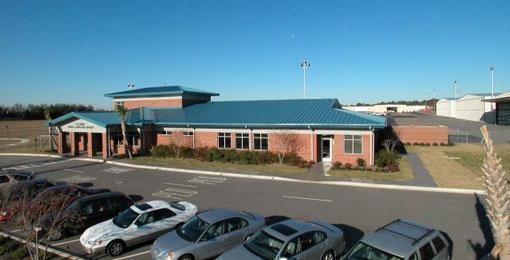
Jim Hamilton - L.B. Owens Airport (IATA: CUB, ICAO: KCUB, FAA LID: CUB) is a county-owned public-use airport located two nautical miles (3.7 km) south of the central business district of Columbia, in Richland County, South Carolina, United States. In 2008, the airport was renamed in honor of former airport manager Jim Hamilton. It was formerly known as Columbia Owens Downtown Airport.
1400 JIM HAMILTON BLVD., COLUMBIA, SC 29205
Phone: 803-931-3161
www.airport-data.com/airport/CUB/
www.globalair.com/airport/airport.aspx?aptcode=KCUB
Elevation: 193 ft / 58.83 m (Surveyed)
Land: 182 acres
From nearest city: 2 nautical miles S of Columbia, SC
Location: Richland County, SC
Magnetic Variation: 06W (1995)
Jim Hamilton - L.B. Owens Airport (IATA: CUB, ICAO: KCUB, FAA LID: CUB) is a county-owned public-use airport located two nautical miles (3.7 km) south of the central business district of Columbia, in Richland County, South Carolina, United States. In 2008, the airport was renamed in honor of former airport manager Jim Hamilton. It was formerly known as Columbia Owens Downtown Airport.
1400 JIM HAMILTON BLVD., COLUMBIA, SC 29205
Phone: 803-931-3161
www.airport-data.com/airport/CUB/
www.globalair.com/airport/airport.aspx?aptcode=KCUB
Wikipedia article: http://en.wikipedia.org/wiki/Jim_Hamilton_–_L.B._Owens_Airport
Nearby cities:
Coordinates: 33°58'18"N 80°59'45"W
- McEntire Joint National Guard Base 16 km
- Shaw Air Force Base 47 km
- Charlotte / Douglas International Airport (CLT/KCLT) 140 km
- Charleston Air Force Base 144 km
- Charleston International Airport (CHS/KCHS) 146 km
- Greenville-Spartanburg International Airport (GSP/KGSP) 155 km
- MCAS Beaufort 165 km
- Hunter Army Airfield 216 km
- Pope Field (POB/KPOB) 225 km
- Piedmont Triad International Airport (GSO) 257 km
- Rosewood neighborhood 0.6 km
- SC State Fairgrounds 2.4 km
- Olympia Mill Village 3.2 km
- Heathwood Hall Episcopal School 3.4 km
- Olympia 3.6 km
- Columbia Quarry 3.9 km
- wastewater treatment facility 4 km
- Wastewater Treatment 4.4 km
- Downtown Columbia 4.7 km
- Congaree Creek Heritage Preseve 4.8 km
Comments