Palauig
Philippines /
Central Luzon /
San Lorenzo /
World
/ Philippines
/ Central Luzon
/ San Lorenzo
World / Philippines / Zambales / Palauig
town, municipality, third-level administrative division

Municipality of Palauig, Province of Zambales
ZIP Code: 2210
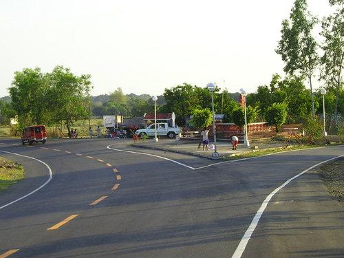
Palauig is a coastal municipality in the province of Zambales in the Philippines. As of the 2010 Census, it had a population of 33,286 people.
The municipality of Palauig is the nearest landmass to the Philippine-claimed EEZ Panatag Shoal, or Scarborough Shoal, and by virtue of proximity, the latter is a designated part of the municipality.
Palauig is politically subdivided into 19 barangays:
-Alwa
-Bato
-Bulawen
-Cauyan
-East Poblacion
-Garreta
-Libaba
-Liozon
-Lipay
-Locloc
-Macarang
-Magalawa
-Pangolingan
-Salaza
-San Juan
-Santo Niño
-Santo Tomas
-Tition (San Vicente)
-West Poblacion
ZIP Code: 2210
Palauig is a coastal municipality in the province of Zambales in the Philippines. As of the 2010 Census, it had a population of 33,286 people.
The municipality of Palauig is the nearest landmass to the Philippine-claimed EEZ Panatag Shoal, or Scarborough Shoal, and by virtue of proximity, the latter is a designated part of the municipality.
Palauig is politically subdivided into 19 barangays:
-Alwa
-Bato
-Bulawen
-Cauyan
-East Poblacion
-Garreta
-Libaba
-Liozon
-Lipay
-Locloc
-Macarang
-Magalawa
-Pangolingan
-Salaza
-San Juan
-Santo Niño
-Santo Tomas
-Tition (San Vicente)
-West Poblacion
Wikipedia article: http://en.wikipedia.org/wiki/Palauig,_Zambales
Nearby cities:
Coordinates: 15°27'2"N 120°2'52"E
- Botolan 12 km
- San Jose 16 km
- Capas 21 km
- Candelaria 33 km
- Mangatarem 48 km
- Subic 50 km
- Santa Cruz 51 km
- Mabini 79 km
- Bokod 144 km
- Kayapa 150 km
- Jump Off 3.1 km
- Dampay, Salaza 3.2 km
- iba minesite 6 km
- Brgy. Kgd. Eranio Mojica / MAFC Chair Residence FARM 7.1 km
- Rocelio Olipane's 8.7 km
- Balin-antik 8.7 km
- Mike Torres Poultry Farm 11 km
- Kitsie's Farm 11 km
- Amungan Farm 12 km
Comments