Lock and Dam 7
USA /
Wisconsin /
French Island /
World
/ USA
/ Wisconsin
/ French Island
World / United States / Wisconsin
dam, lock (water navigation)
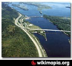
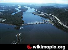

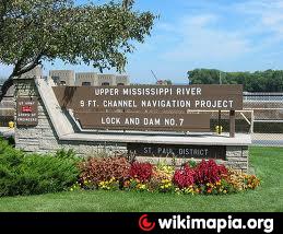
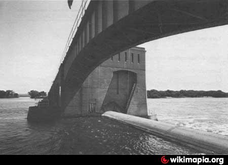

Part of the Army Corps of Engineers Mississippi River Lock and Dam system.
www.mvp.usace.army.mil/navigation/default.asp?pageid=14...
www.mvp.usace.army.mil/navigation/default.asp?pageid=14...
Wikipedia article: http://en.wikipedia.org/wiki/Lock_and_Dam_No._7
Nearby cities:
Coordinates: 43°51'57"N 91°17'35"W
- Lock and Dam No. 12 191 km
- Coon Rapids Dam Regional Park (Anoka County) 216 km
- Fort Randall Dam 595 km
- Virginia Smith Dam 685 km
- Oahe Dam 731 km
- Garrison Dam 886 km
- Homstake Mining Company Tailings Impoundment 996 km
- Fort Peck Dam 1260 km
- Qu'Appelle Dam 1385 km
- Gardiner Dam 1429 km
- Round Lake 1.1 km
- La Crosse Regional Airport (LSE/KLSE) 3.4 km
- Nelson Park 3.4 km
- Lake Onalaska 4.2 km
- Rosebud Island 5.1 km
- Midway, Wisconsin 8 km
- La Crosse County Landfill 11 km
- State Forest Land 11 km
- Great River Bluffs State Park 12 km
- Lake Neshonoc 19 km