Maeslantkering flood barrier
Netherlands /
Zuid-Holland /
Brielle /
Maeslantkeringweg
World
/ Netherlands
/ Zuid-Holland
/ Brielle
World / Netherlands / Zuid-Holland
flood protection
Add category

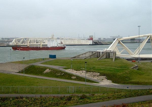


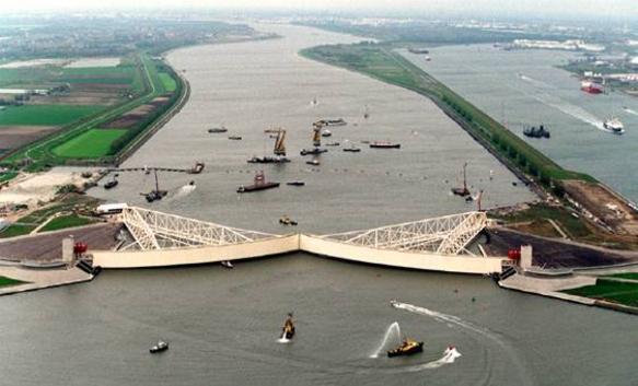
Flood barrier on the Maas River. Each of the arms is as large as the Eiffel Tower.
Wikipedia article: http://en.wikipedia.org/wiki/Maeslantkering
Nearby cities:
Coordinates: 51°57'16"N 4°9'48"E
- Neeltje-Jans 49 km
- Buków flood polder 1011 km
- St.Petersburg Dam - North section 1814 km
- Youghiogheny River Lake 6250 km
- J.E. Roush Fish and Wildlife Area 6546 km
- Addicks Reservoir 8072 km
- Sutter Bypass 8618 km
- Yolo Bypass 8658 km
- Cache Creek Settling Basin 8663 km
- Moutoa Floodway 18591 km
- Calandcanal 1.7 km
- Shell Europort Terminal 1.8 km
- Hoek of Holland 1.9 km
- Europoort 2.2 km
- Dintelhaven 2.8 km
- New Waterway 3.3 km
- Westland (Municipality) 6 km
- Maassluis (municipality) 6.9 km
- Rotterdam (municipality) 8.2 km
- South Holland 23 km
Comments