Old Clark County Courthouse (Jeffersonville, Indiana)
USA /
Indiana /
Jeffersonville /
Jeffersonville, Indiana
World
/ USA
/ Indiana
/ Jeffersonville
World / United States / Indiana
historical layer / disappeared object
Add category
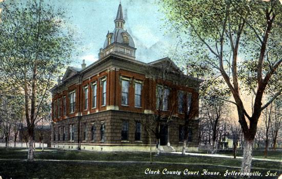
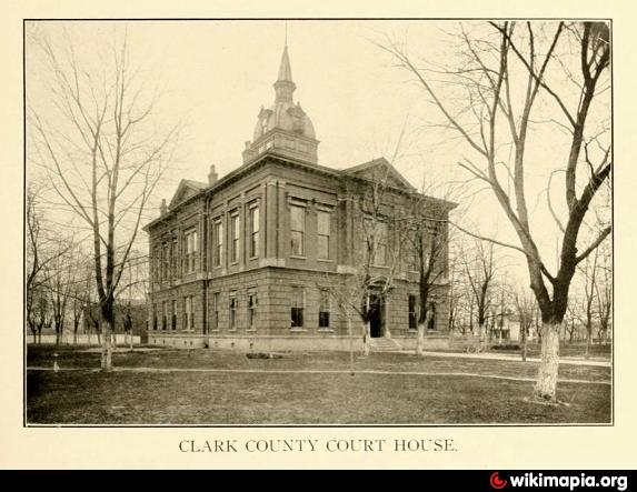
The first county seat and court was established in Springville, Indiana on April 7, 1801.
The platting of Jeffersonville occurred a year later and the county seat was fixed to
Jeffersonville on June 9, 1802 by order of Governor William Henry Harrison.
By December 14, 1810 the county seat changed for the third time to Charlestown and it would remain there until 1878. The county seat changed for one last time on September 23, 1878 and returned to Jeffersonville with then mayor Luther Warder campaigning for the county seat's return.
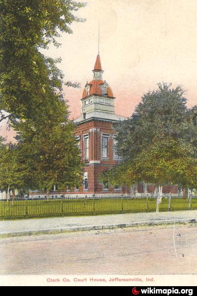
The city donated land north of New Market Street (Court Avenue), between Watt Street and
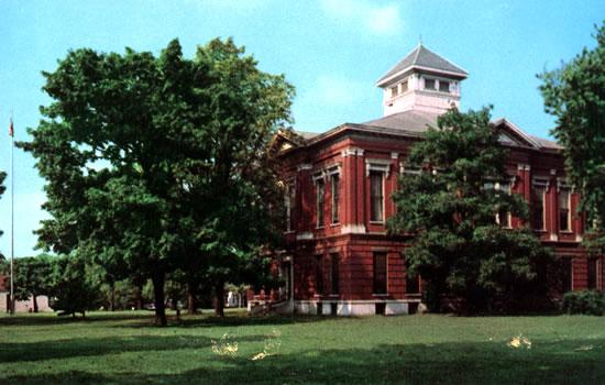
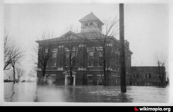
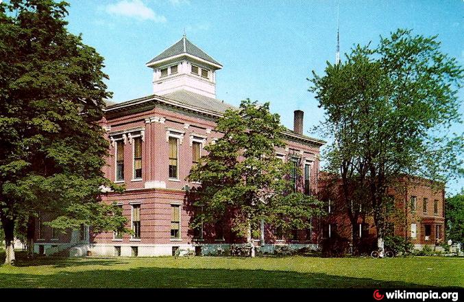
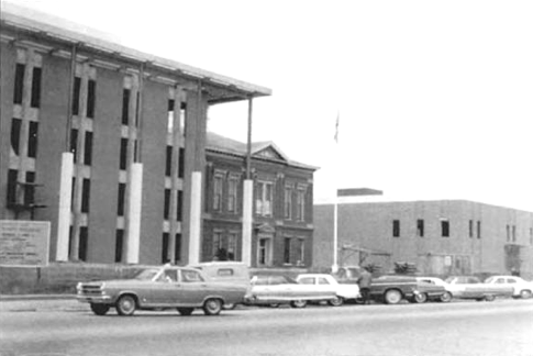
Meigs Avenue for the courthouse. The building lost its tall cupola and spire in the 1930s
after a lightning strike. Replaced in 1970 by a new county complex built around the
existing structure. The offices were moved into the new building and the old one torn down.
The platting of Jeffersonville occurred a year later and the county seat was fixed to
Jeffersonville on June 9, 1802 by order of Governor William Henry Harrison.
By December 14, 1810 the county seat changed for the third time to Charlestown and it would remain there until 1878. The county seat changed for one last time on September 23, 1878 and returned to Jeffersonville with then mayor Luther Warder campaigning for the county seat's return.
The city donated land north of New Market Street (Court Avenue), between Watt Street and
Meigs Avenue for the courthouse. The building lost its tall cupola and spire in the 1930s
after a lightning strike. Replaced in 1970 by a new county complex built around the
existing structure. The offices were moved into the new building and the old one torn down.
Nearby cities:
Coordinates: 38°16'38"N 85°44'12"W
- Camp Powers 2.6 km
- Clarksville Airport 4.4 km
- Town of Ohio Falls (1854-1875) 5.3 km
- Hamburg, Indiana 13 km
- Heritage Creek, Kentucky 16 km
- Indiana Army Ammunition Plant 22 km
- Track of March, 2012 Tornado 30 km
- Former Railroad Bed 48 km
- Dog Walk Civil War Battlefield 71 km
- former site of Burnside 174 km
- Old Jeffersonville Historic District 0.4 km
- Atkins Quarry 2.8 km
- Falls of the Ohio National Wildlife Conservation Area 2.9 km
- Shippingport Island 3.8 km
- Louisville and Portland Canal 4 km
- Ohio River Greenway 4 km
- Portland neighborhood 5 km
- West End 6.4 km
- Floyd County, Indiana 14 km
- Clark County, Indiana 18 km