Gazipur District Town
Bangladesh /
Gazipur /
Tungi /
World
/ Bangladesh
/ Gazipur
/ Tungi
World / Bangladesh / Dhaka / Dhaka / Gazipur
third-level administrative division, town district
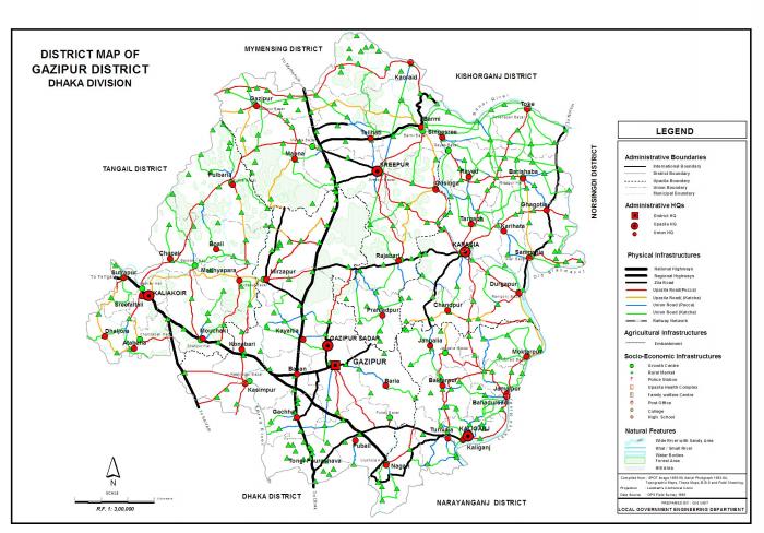

Gazipur District (Dhaka division) with an area of 1741.53 sq km, is bounded by Mymensingh and Kishoreganj districts on the north, Dhaka, Narayanganj and Narsingdi districts on the south, Narsingdi on the east, Dhaka and Tangail districts on the west. Annual average temperature maximum 36°C and minimum 12.7°C; annual rainfall 2376 mm. Main rivers: Old Brahmaputra, Shitalakshya, Turag, Bangshi, Balu, Banar.
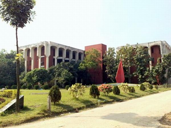
The location of Gazipur district town is 23.9994004N 90.4099733E. Gazipur (Town) consists of 9 wards and 31 mahallas. The area of the town is 49.32 sq km. The town has a population of 123531; male 52.52%, female 47.48%; density of population is 2505 per sq km. Various establishments such as Bangladesh Rice Research Institute (BRRI), Bangladesh Agricultural Research Institute (BARI), CERDI, Seed Certifying Agency, Security Printing, Machine Tools Factory, Bangladesh Ordnance Factory, Diesel Plant, Bangladesh Institute of Technology (BIT), BRAC Dairy Farm, Cremation Ghat etc are located here.
Gazipur district was established in 1984. It consists of 5 upazilas, 46 union parishads, 710 mouzas, 2 municipalities and 1163 villages. The upazilas are gazipur sadar, kaliakair, kaliganj, kapasia and sreepur.
Archaeological heritage: Dholsamundra at Boali, Toke Badshahi Mosque; Dighi and mazar at Chaura; old bridge (built by Meer Jumla) at Tangi, Bhawal Rajbari at Joydebpur.
As of the 1991 Bangladesh census, Population 2026244; male 51.77%, female 48.23%; Muslim 91.9%, Hindu 7.5%, Christian 0.4%, Others 0.2%,; ethnic nationals: Rajbangshi (Koch), Garo, Mandi, etc.
Religion institutions Mosque 2730, temple 143, church 12, mazar 4 and sacred place 6.
Literacy rate and educational institutions Average literacy 36, 25%; male 43.2% and female 29.3%. Educational institutions: university 3, technical institution 2, agricultural institution 4, government college 3, non-government college 19, madrasa 160, government secondary school 3, non-government secondary school 258, junior school 39, government primary school 532, non-government primary school 177, madrasa 108, primary training institute 1, scout training centre (Mouchak) 1, madrasa teacher's training institute 1, tele-communication staff college 1, agricultural training institute 1.
Cultural organisations Club 200, public library 4, cinema hall 19, community centre 10, museum 3, theatre stage 1, theatre group 20, literary society 2, women's cooperative society 89, Shilpakala academy 1, Shishu academy 1, women's association 3.
Main occupations Agriculture 45.73%, agricultural labourer 11.73%, wage labourer 2.65%, commerce 10.85%, transport 2.79%, construction 1.1%, service 14.41%, others 10.74%.
Land use Total land under cultivation 125287.53 hectares, fallow land 16935.35 hectares; single crop 34.84%, double crop 50.76%, treble crop 14.40%, land under irrigation 41.18%.
Land control Landless 11.60%, marginal 38.80% intermediate 30.40%, and 19.20% rich.
Main crops Paddy, jute, mustard seed, sugarcane, chilli, arum, turmeric, ginger.
Fisheries, poultries and dairies Poultry 8511, dairy 114, fishery 646 and hatchery 7.
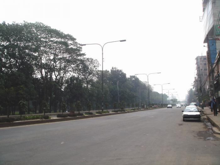
Communication facilities Roads: pucca 600 km, semi pucca 348 km, mud roads 2692 km, railways 86 km; waterways 146 nautical mile.
Traditional transport nearly extinct: Duli, palanquin, country boat, horse carriage, bullock cart, Konda (a kind of boat made of palm tree).
Manufactories: Aluminium factory, textile mill, pharmaceutical industry, cosmetics industry, machine tools factory, diesel plant, security printing press, ordnance factory, ceramics factory, packaging industry, brick field and garments industry, etc.
Cottage industries: Weaving, goldsmith, blacksmith, potteries, bamboo and cane work, tailoring, bidi, nakshi kantha work, shital pati, wood work etc.
NGO activities: brac, asa, Hunger, proshika, World Vision, ABC, Dialogue, Swanirvar Bangladesh (Self Reliant Bangladesh), Pidim etc.
Health centres: District sadar hospital 1, upazila health complex 5, health and family welfare centres 30, private hospital 5, Ansar academy and ordnance factory hospital 2, union health centre 7, missionaries hospital 1, NGO run hospital 10.
The location of Gazipur district town is 23.9994004N 90.4099733E. Gazipur (Town) consists of 9 wards and 31 mahallas. The area of the town is 49.32 sq km. The town has a population of 123531; male 52.52%, female 47.48%; density of population is 2505 per sq km. Various establishments such as Bangladesh Rice Research Institute (BRRI), Bangladesh Agricultural Research Institute (BARI), CERDI, Seed Certifying Agency, Security Printing, Machine Tools Factory, Bangladesh Ordnance Factory, Diesel Plant, Bangladesh Institute of Technology (BIT), BRAC Dairy Farm, Cremation Ghat etc are located here.
Gazipur district was established in 1984. It consists of 5 upazilas, 46 union parishads, 710 mouzas, 2 municipalities and 1163 villages. The upazilas are gazipur sadar, kaliakair, kaliganj, kapasia and sreepur.
Archaeological heritage: Dholsamundra at Boali, Toke Badshahi Mosque; Dighi and mazar at Chaura; old bridge (built by Meer Jumla) at Tangi, Bhawal Rajbari at Joydebpur.
As of the 1991 Bangladesh census, Population 2026244; male 51.77%, female 48.23%; Muslim 91.9%, Hindu 7.5%, Christian 0.4%, Others 0.2%,; ethnic nationals: Rajbangshi (Koch), Garo, Mandi, etc.
Religion institutions Mosque 2730, temple 143, church 12, mazar 4 and sacred place 6.
Literacy rate and educational institutions Average literacy 36, 25%; male 43.2% and female 29.3%. Educational institutions: university 3, technical institution 2, agricultural institution 4, government college 3, non-government college 19, madrasa 160, government secondary school 3, non-government secondary school 258, junior school 39, government primary school 532, non-government primary school 177, madrasa 108, primary training institute 1, scout training centre (Mouchak) 1, madrasa teacher's training institute 1, tele-communication staff college 1, agricultural training institute 1.
Cultural organisations Club 200, public library 4, cinema hall 19, community centre 10, museum 3, theatre stage 1, theatre group 20, literary society 2, women's cooperative society 89, Shilpakala academy 1, Shishu academy 1, women's association 3.
Main occupations Agriculture 45.73%, agricultural labourer 11.73%, wage labourer 2.65%, commerce 10.85%, transport 2.79%, construction 1.1%, service 14.41%, others 10.74%.
Land use Total land under cultivation 125287.53 hectares, fallow land 16935.35 hectares; single crop 34.84%, double crop 50.76%, treble crop 14.40%, land under irrigation 41.18%.
Land control Landless 11.60%, marginal 38.80% intermediate 30.40%, and 19.20% rich.
Main crops Paddy, jute, mustard seed, sugarcane, chilli, arum, turmeric, ginger.
Fisheries, poultries and dairies Poultry 8511, dairy 114, fishery 646 and hatchery 7.
Communication facilities Roads: pucca 600 km, semi pucca 348 km, mud roads 2692 km, railways 86 km; waterways 146 nautical mile.
Traditional transport nearly extinct: Duli, palanquin, country boat, horse carriage, bullock cart, Konda (a kind of boat made of palm tree).
Manufactories: Aluminium factory, textile mill, pharmaceutical industry, cosmetics industry, machine tools factory, diesel plant, security printing press, ordnance factory, ceramics factory, packaging industry, brick field and garments industry, etc.
Cottage industries: Weaving, goldsmith, blacksmith, potteries, bamboo and cane work, tailoring, bidi, nakshi kantha work, shital pati, wood work etc.
NGO activities: brac, asa, Hunger, proshika, World Vision, ABC, Dialogue, Swanirvar Bangladesh (Self Reliant Bangladesh), Pidim etc.
Health centres: District sadar hospital 1, upazila health complex 5, health and family welfare centres 30, private hospital 5, Ansar academy and ordnance factory hospital 2, union health centre 7, missionaries hospital 1, NGO run hospital 10.
Nearby cities:
Coordinates: 24°0'18"N 90°24'37"E
- Narsingdi District 32 km
- Habigonj District 115 km
- Feni 117 km
- Khagrachari District 137 km
- Bhola District Town 144 km
- Sunamganj District 145 km
- Maulvibazar District 150 km
- Rangamati District 166 km
- Sylhet District 180 km
- Jiuzhaigou County 1668 km
- Dhaka University Of Enginnering and Technology(DUET) 1.6 km
- Bangladesh Agriculture Research Institute (BARI) 1.8 km
- Bangladesh Rice Research Institute (BRRI) ( ধান গবেষণা ইন্সটিটিঊট ) 1.8 km
- Bangladesh Machine Tools Factory 2.8 km
- Bangladesh Ordnance Factory (BOF) 3.6 km
- Bangabandhu Agriculture University 3.8 km
- KHODE BORMI 3.9 km
- West Chatar প: চতর 4 km
- Gazipur District 10 km
- Dhaka Division 17 km
Dhaka University Of Enginnering and Technology(DUET)
Bangladesh Agriculture Research Institute (BARI)
Bangladesh Rice Research Institute (BRRI) ( ধান গবেষণা ইন্সটিটিঊট )
Bangladesh Machine Tools Factory
Bangladesh Ordnance Factory (BOF)
Bangabandhu Agriculture University
KHODE BORMI
West Chatar প: চতর
Gazipur District
Dhaka Division