Canyon Ferry Dam
USA /
Montana /
Winston /
World
/ USA
/ Montana
/ Winston
World / United States / Montana
dam
Add category

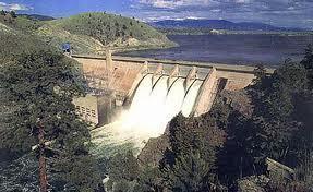
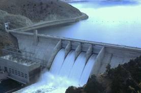
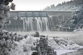

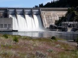

Canyon Ferry Dam is a concrete gravity dam built in a narrow constriction of the Missouri River Valley, where the Big Belt Mountains and the Spokane Hills merge.
Wikipedia article: http://en.wikipedia.org/wiki/Canyon_Ferry_Dam
Nearby cities:
Coordinates: 46°38'54"N 111°43'40"W
- Fort Peck Dam 425 km
- Qu'Appelle Dam 619 km
- Gardiner Dam 625 km
- Homstake Mining Company Tailings Impoundment 673 km
- Garrison Dam 785 km
- Oahe Dam 913 km
- Fort Randall Dam 1110 km
- Virginia Smith Dam 1130 km
- Coon Rapids Dam Regional Park (Anoka County) 1432 km
- Lock and Dam No. 12 1755 km
- Canyon Ferry, Montana 1.6 km
- Cemetery Island 2.3 km
- Hellgate Campground 7 km
- Hauser Lake 9 km
- Canyon Ferry Lake 18 km
- Confederate Gulch, Diamond City, and the Montana Bar. 24 km
- Moors Mountain 27 km
- Stoyanoff Lake 36 km
- Fort Logan Ranch 43 km
- Millegan, Montana 50 km