Dzukou Valley
India /
Nagaland /
Kohima /
World
/ India
/ Nagaland
/ Kohima
World / India / Manipur / Senapati
valley
Add category
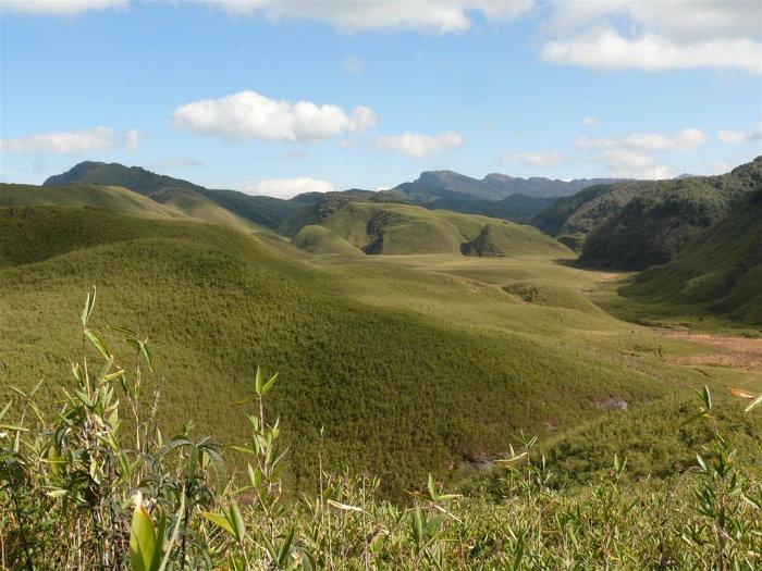
A place of scenic beauty ideal for trekking & hiking. The Dzuko river flows through this valley adding to blessings of the mother nature, and nudging the state.
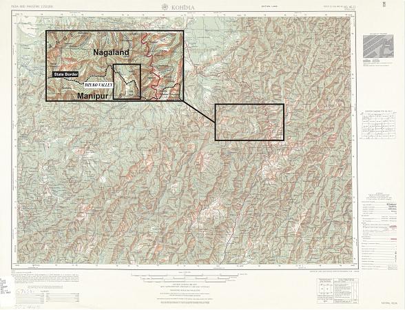
Lying partly in Nagaland and Manipur, the valley is located at a height of 2438 mts. above sea level. It is home to numerous vegetation including the endemic Dzukou Lily.
Lying partly in Nagaland and Manipur, the valley is located at a height of 2438 mts. above sea level. It is home to numerous vegetation including the endemic Dzukou Lily.
Nearby cities:
Coordinates: 25°34'55"N 94°1'7"E
- Umswai (valley) 188 km
- ChinDwin River, one of the major rivers of Myanmar. This river merges into AyeYarWady River. 423 km
- Phobjikha Valley 442 km
- Za Qu valley (Mekong valley) 783 km
- Qi Zang Gou 1249 km
- Ia Drang Valley 1948 km
- Lam Tsuen Valley 2071 km
- Pallas Valley 2863 km
- Takachiho Gorge 3690 km
- Malango Valley 4017 km
- Khonoma 7.6 km
- dziilekie 8 km
- BENBDRAMAI 8.8 km
- Ze mnui village 8.9 km
- Kedie grave 10 km
- Poilwa Vllage. more then 1000 houses. 11 km
- Biendireu, Forest 13 km
- Chakha Part-II(Senapati Dist) 17 km
- Peren District the Rice Bowl of Nagaland. 39 km
- Manipur 86 km
Comments