Founder's Rock (Berkeley, California)
USA /
California /
Berkeley /
Berkeley, California
World
/ USA
/ California
/ Berkeley
World / United States / California
place with historical importance, historical marker, outcrop (rocks), NRHP - National Register of Historic Places
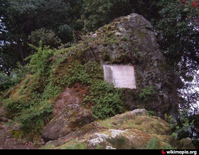
On the corner of Hearst Avenue and Gayley Road, in Berkeley, California, lies the Founders' Rock, the spot, according to college lore, where the 12 trustees of the College of California, the nascent University of California, Berkeley, stood on April 16, 1860, to dedicate the property they had just purchased. This is, supposedly, the same spot where Frederick Billings stood in 1866 when he remembered Bishop Berkeley's verse -- "Westerward the course of empire takes it way" -- and thus inspired the name of the new city. A plaque was put on this spot on Charter Day in 1896.
National Register of Historic Places # 82004642
City of Berkeley landmark # 149
National Register of Historic Places # 82004642
City of Berkeley landmark # 149
Wikipedia article: http://en.wikipedia.org/wiki/Founders'_Rock
Nearby cities:
Coordinates: 37°52'31"N 122°15'25"W
- Oakland-Berkeley Hills Firestorm Site 1.4 km
- Berkeley Pier Ruins 9 km
- Alameda Point 11 km
- Oak Knoll Naval Hospital 15 km
- Lake Chabot Machine Gun Range (site) 19 km
- Buchanan Field Airport/Concord Army Airfield (CCR/KCCR) 22 km
- Former Mare Island Naval Shipyard 27 km
- Port Chicago, California 28 km
- Black Diamond Mines Regional Preserve 34 km
- Original Site of Rancho Los Meganos 43 km
- UC-Berkeley Department of Chemistry 0.3 km
- Northside 0.4 km
- Grinnell Natural Area 0.8 km
- West Circle 0.9 km
- Evans Diamond 0.9 km
- Southside 0.9 km
- Edwards Track Stadium with Goldman Field 1 km
- University of California, Berkeley 1.3 km
- Downtown Berkeley 1.3 km
- San Francisco Bay 18 km