AT&T "Peters Mountain" Project Office
USA /
Virginia /
Gordonsville /
World
/ USA
/ Virginia
/ Gordonsville
World / United States / Virginia
military, Cold War 1947-1991, bunker, microwave tower / microwave transmission, tropospheric scatter station


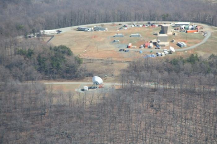
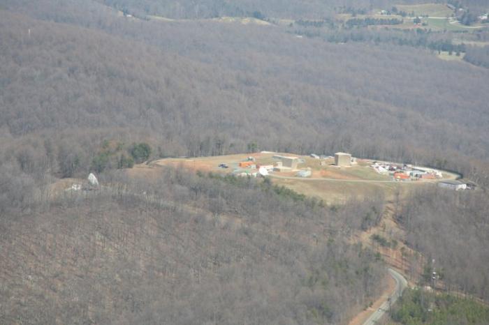
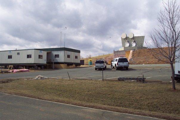
Part of the troposcatter communications network built by AT&T in the late 1950's as a communications relay station between the Project Offices at Leesburg and Hagerstown, the Peters Mountain site went operational in the mid-1960s and remains operational today, though the troposcatter links are no longer in operation. Originally outfitted to transmit communications on the Automatic Voice Network (AUTOVON) system, the majority of facility infrastructure was located in a subterranean bunker which was nuclear-hardened to ensure operation in the event of attack.
The site is still owned and operated by AT&T and was extensively upgraded as recently as 2007 with modern communications equipment.
www.coldwar-c4i.net/ATT_Project/VA06/index.html
The site is still owned and operated by AT&T and was extensively upgraded as recently as 2007 with modern communications equipment.
www.coldwar-c4i.net/ATT_Project/VA06/index.html
Wikipedia article: https://en.wikipedia.org/wiki/Project_Offices
Nearby cities:
Coordinates: 38°7'32"N 78°17'9"W
- Trevilian Station Battlefield 19 km
- Aerojet Propellant Lab 37 km
- Point of Fork Plantation 42 km
- Brandy Station Battlefield Park 59 km
- New Market Battlefield State Historical Park 70 km
- Warrenton Training Center - Station B 79 km
- C-130 Assault Airstrip 80 km
- Marine Corps Base Quantico 85 km
- Quantico MCD Depot 90 km
- Atlantic Research Corporation Missile Test Facility 96 km
- Southwest Mountains Rural Historic District 4.9 km
- Rocklands 10 km
- Ruckersville, Virginia 14 km
- Green Springs National Historic Landmark District 15 km
- Albemarle County, Virginia 25 km
- Orange County, Virginia 26 km
- Greene County, Virginia 28 km
- Fluvanna County, Virginia 31 km
- Louisa County, Virginia 33 km
- Madison County, Virginia 34 km
Comments