FAA Air Traffic Control Tower (ATCT) and Terminal Radar Approach Control (TRACON) building (Indianapolis, Indiana)
USA /
Indiana /
Plainfield /
Indianapolis, Indiana
World
/ USA
/ Indiana
/ Plainfield
World / United States / Indiana
air traffic control tower, fenced area, 2000s construction
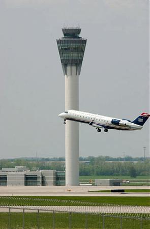
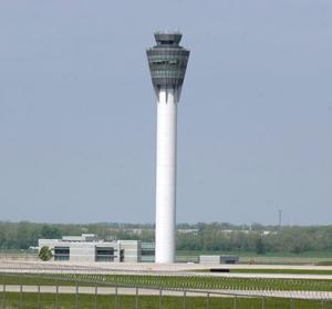
340 feet tall - Opened in April 2006 (replaced 1972 tower since demolished)
Nearby cities:
Coordinates: 39°42'30"N 86°18'16"W
- Indianapolis Air Route Traffic Control Center (ZID) 4 km
- Memphis Air Route Traffic Control Center (ARTCC) 609 km
- FAA Control Tower complex 612 km
- PAAFNG Air Traffic Control Squadron 641 km
- Potomac Consolidated TRACON (PCT) 752 km
- Washington Center - Air Traffic Control 756 km
- Marine Air Control Squadron 2 (Beaufort Det.) 951 km
- US Air Traffic Control 1032 km
- New York Air Route Traffic Control Center (ZNY) 1127 km
- SpaceX Operations Area (Under Construction) 1346 km
- Economy Lot 0.3 km
- Indianapolis International Airport (IND/KIND) 0.5 km
- FedEx Express Indianapolis National Hub 1.8 km
- USPS Eagle Network Hub (closed) 1.9 km
- Interstate 70 Exit 73/Interstates 74/465 Exit 9 Interchange 3.6 km
- Washington Industrial Park 3.9 km
- Infosys U.S. Education Center 4 km
- Countryside 4.1 km
- Decatur Township 5.3 km
- Wayne Township 8 km