Gaspe Mines
Canada /
Quebec /
Murdochville /
World
/ Canada
/ Quebec
/ Murdochville
World / Canada / Québec / La Côte-de-Gaspé
mine, copper mine, metallurgy, mining, smelter
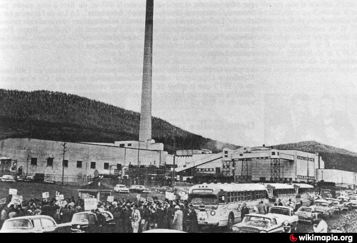
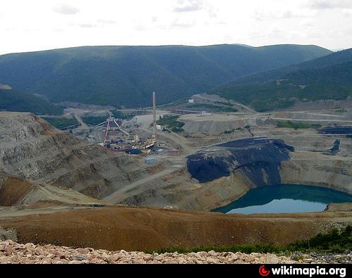
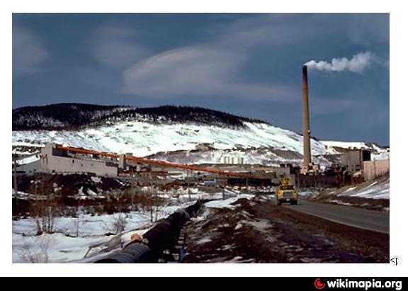
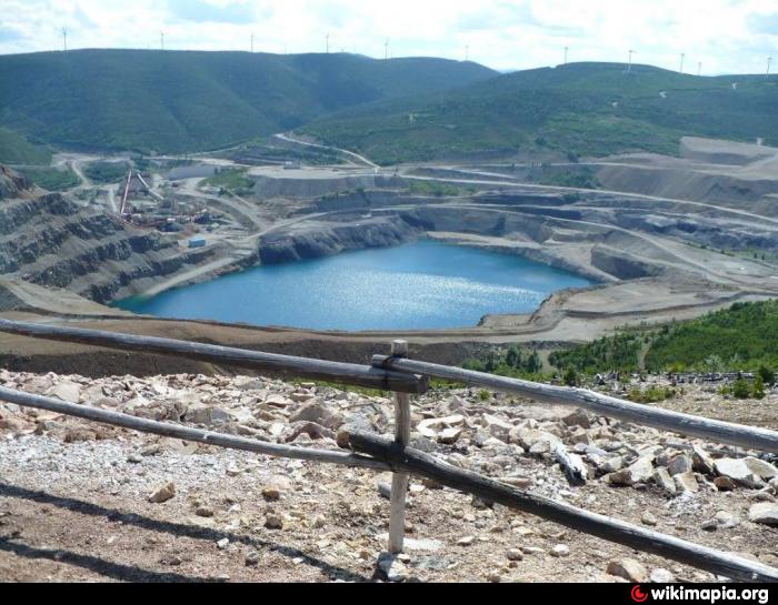
Gaspe Mines, closed after 50 years of copper extraction from two open pits and a complex underground mine. Mine site also included mills and a smelter. The Dark square in the centre is the open pit, now filling with ground water. The pink areas are how Landsat represents "unvegetated land cover".
www.murdochville.com/ville/history.html
www.murdochville.com/ville/history.html
Nearby cities:
Coordinates: 48°58'0"N 65°31'21"W
- Brunswick Mine 166 km
- Springhill 383 km
- Mount Pleasant Mine 406 km
- Bloom Lake iron mine 449 km
- National Gypsum quarry 466 km
- Cochrane Hill Mining Area 490 km
- Brazil Lake Lithium Prospect 555 km
- Schefferville 663 km
- Silver Yard, Labrador Iron Ore mines 670 km
- KeMeg iron ore deposit 701 km
- Mont Copper Wind Farm 2.4 km
- Gaspe Mines tailings dump 5.8 km
- Exploration Orbite mining area 23 km
- Mont Louis Wind Farm 26 km
- Collines-du-Basque (Hills of the Basque) 27 km
- Gros-Morne Wind Farm 27 km
- Montagne-Sèche Wind Farm 48 km
- Gaspésie National Park / Parc national de la Gaspésie 57 km
- Anse-à-Valleau Wind Farm 66 km
- Matamec Lake 157 km