Kedarkantha
India /
Uttaranchal /
Barkot /
World
/ India
/ Uttaranchal
/ Barkot
World / India / Uttaranchal / Uttarkashi
mountain, himalaya


Kedar === Lord Shiva; kantha === neck.
Height of the peak/ Top: 3810m.
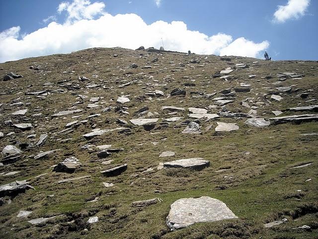
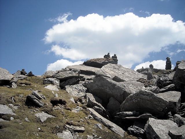
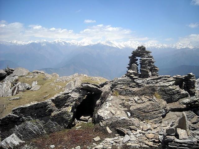
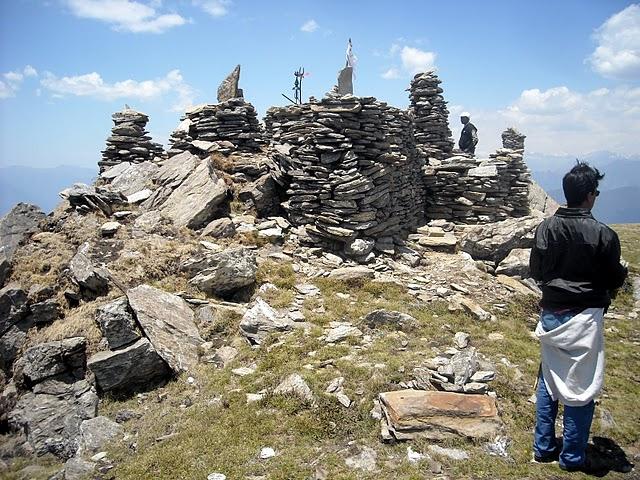
Kedarkantha peak or top , situated in the mountains of the Tons river valley is a beautiful rounded peak and is a popular trekking destination most times of the year. Even in winters a trek to Kedarkantha is possible as it goes through dense forests and vast meadows making the trail walkable even in snow. The trek goes through the Govind national park and gives you ample time to soak in the flora and fauna of this protected area. Here is the route that most professional trekkers take. It is advised that due to remoteness and sheer wilderness of the areas, readers should employ services of professionals to take them on this venture.
The Youth hostel association of India (www.yhaindia.org) organises trek during the month of May.
Height of the peak/ Top: 3810m.
Kedarkantha peak or top , situated in the mountains of the Tons river valley is a beautiful rounded peak and is a popular trekking destination most times of the year. Even in winters a trek to Kedarkantha is possible as it goes through dense forests and vast meadows making the trail walkable even in snow. The trek goes through the Govind national park and gives you ample time to soak in the flora and fauna of this protected area. Here is the route that most professional trekkers take. It is advised that due to remoteness and sheer wilderness of the areas, readers should employ services of professionals to take them on this venture.
The Youth hostel association of India (www.yhaindia.org) organises trek during the month of May.
Nearby cities:
Coordinates: 31°1'21"N 78°10'17"E
- Kalindi Khal 106 km
- Arwa Nala 119 km
- Ghastoli 125 km
- Deoban, 6855m 142 km
- Yangzi Diwan Pass 162 km
- Ranikhet 188 km
- Roshi Bazar, Roshi Khola, 807 km
- Hongu Valley 925 km
- Koloriang 1509 km
- Mêdog (Motuo Xian) 1659 km
- REVRI VILLAGE BY KIMTA 10 km
- Lush green deoadar forest Gundiyat Gaon 11 km
- Gunati village 11 km
- Pine woods Gundiyat Goan 11 km
- Gundiyat Gaon 11 km
- Nachana village 12 km
- village sarnaul 12 km
- Jawahar Navodaya Vidyalaya Dhungiri 14 km
- Village baina 14 km
- Upla Math 15 km