Transalpina (DN 67C)-offroad
Romania /
Gorj /
Novaci /
World
/ Romania
/ Gorj
/ Novaci
World / Romania
mountain, road


www.youtube.com/watch?v=T9CJVQDpp-w
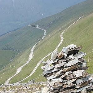
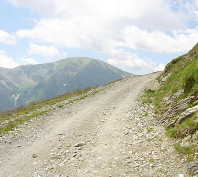
The Transalpina or DN67C located in the Parâng Mountains group, in the Southern Carpathians, is one of the most spectacular roads of the Carpathian Mountains. It connects Novaci, south of Parâng Mountains, to Sebeş in the north.
It is said that the road was built under King Carol II and rebuilt during World War II by German troops and it is called "The King's Road" by the locals. Also a story has it that Ceauşescu had the Transfăgărăşan Road (DN7C) built during the communist regime just to surpass the Transalpina.
The road has its highest point at Urdele Pass, where the elevation is 2,145m above sea level. Given the high altitude, the road is closed during the cold months of the year.
Rânca, a newly developed resort, is located towards the south end of the Transalpina road.
Wikipedia article: http://en.wikipedia.org/wiki/Transalpina_(DN_67C)
Nearby cities:
Coordinates: 45°21'44"N 23°39'14"E
- Ranca Touristic Area 5.4 km
- Novaci 16 km
- Parâng Touristic Area 18 km
- lui Pătru Mountain 23 km
- Mount Jigoru Mare 33 km
- Mount Strâmbu 37 km
- Mount Rudii 39 km
- Măgura Uroiului 74 km
- Retezat National Park 83 km
- Beritia 89 km
- Rosiile Lake 8 km
- Obarsian Lotreville 8.3 km
- Vidra Lake 10 km
- Vidra - planned to be a mountain resort, never finished 11 km
- Vidra 11 km
- Oașa Dam 22 km
- Cindrel Natural Park 25 km
- Luncile Prigoanei 25 km
- Cugir administrative area 46 km
- Sibiu County 76 km
Comments