Mount Slamet 3428m
Indonesia /
Jawa Tengah /
Baturaden /
Kab. Tegal dan Kab. Pemalang
World
/ Indonesia
/ Jawa Tengah
/ Baturaden
World / Indonesia / Jawa Tengah
mountain, volcano, forest, stratovolcano, national park, animal sanctuary
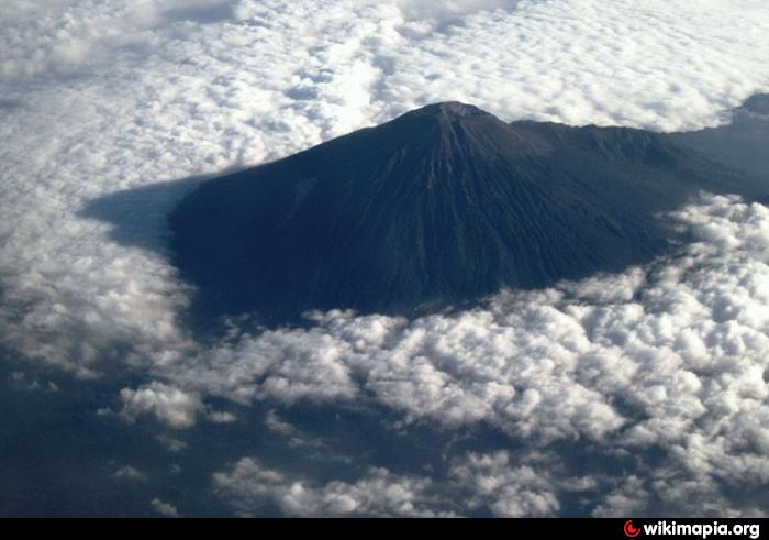
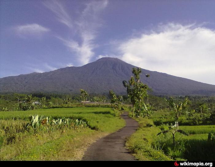
Slamet, Java's second highest volcano at 3428 m and one of its most active, has a cluster of about three dozen cinder cones on its lower eastern flanks and a single cinder cone on the western flank. It is composed of two overlapping edifices, an older basaltic-andesite to andesitic volcano on the west and a younger basaltic to basaltic-andesite one on the east. Gunung Malang II cinder cone on the upper east flank on the younger edifice fed a lava flow that extends 6 km east. Four craters occur at the summit of Gunung Slamet, with activity migrating to the southwest over time. Historical eruptions, recorded since the 18th century, have originated from a 150-m-deep, 450-m-wide, steep-walled crater at the western part of the summit and have consisted of explosive eruptions generally lasting a few days to a few weeks.
Wikipedia article: http://en.wikipedia.org/wiki/Mount_Slamet
Nearby cities:
Coordinates: 7°14'29"S 109°12'56"E
- South Gombong Mountain Karst 49 km
- Ciremai Volcano, 3078 m 101 km
- Syawal Mount National Park 107 km
- Mt. Galunggung 130 km
- Mt. Tampomas (1684 m) 153 km
- Mt. Papandayan (2665 m) 168 km
- Mt. Malabar (2.329 m) 180 km
- Mount Kendeng Forest Reserve 226 km
- Gunung Gede - Pangrango (2,958 m - 3,019 m) 260 km
- Mount Gede Pangrango National Park 271 km
- Slamet Crater (average 3.328 m / 10.919 ft) 0.1 km
- Daerah Puncak Gunung Slamet 0.1 km
- Gunung Slamet Forest Protected 5.6 km
- Desa Gunung Sari 7.2 km
- Wana Wisata Guci (Wagu) 7.3 km
- Guciku Hot Waterboom 7.9 km
- Kab. Tegal 25 km
- Tegal Regency 25 km
- Pemalang Regency 33 km
- Central Java (Jawa Tengah) 100 km
Comments