The Verrazano-Narrows Bridge
USA /
New Jersey /
Bayonne /
World
/ USA
/ New Jersey
/ Bayonne
World / United States / New Jersey
road bridge, suspension bridge, 1964_construction
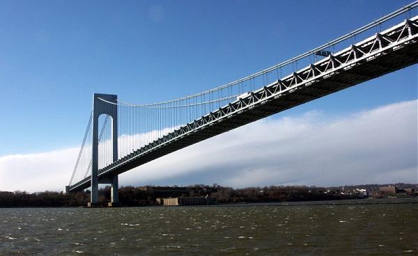
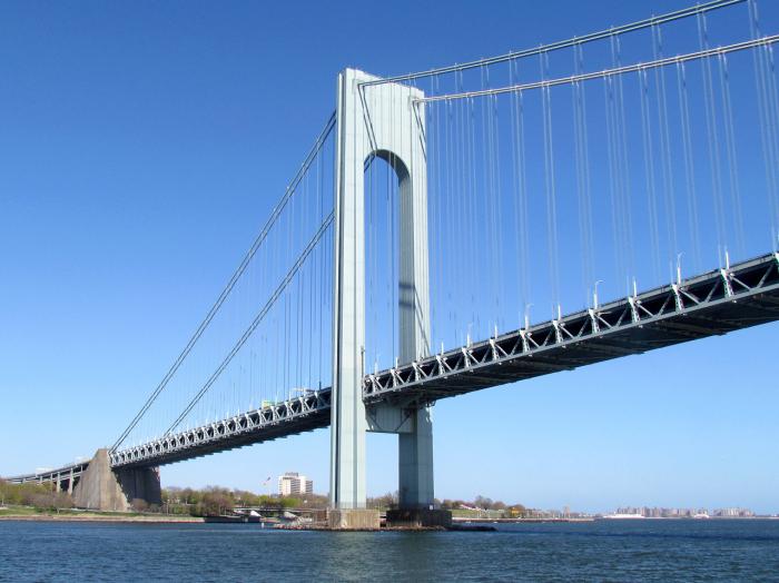

When it opened in 1964, the Verrazano-Narrows Bridge was the world's longest suspension span. The ends of the bridge are at historic Fort Hamilton in Brooklyn and Fort Wadsworth in Staten Island, both of which guarded New York Harbor at the Narrows for over a century. The bridge was named after Giovanni da Verrazano, who, in 1524, was the first European explorer to sail into New York Harbor.
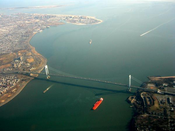
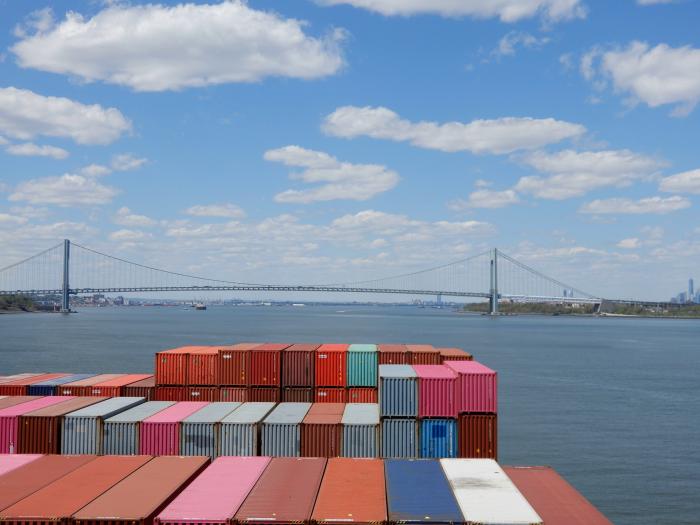
The bridge furnishes a critical link in the local and regional highway system. It is the starting point of the New York City Marathon. The bridge marks the gateway to New York Harbor; all cruise ships and most container ships arriving at the Port of New York and New Jersey must pass underneath the bridge and thus must be built to accommodate the clearance under the bridge.
The bridge was the last great public works project in New York City overseen by Robert Moses, the New York State Parks Commissioner and head of the Triborough Bridge and Tunnel Authority.
Among local residents, it is often referred to as simply "the Verrazano".
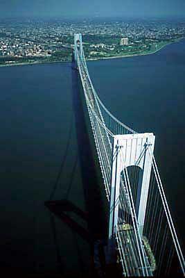
Its monumental 693 foot high towers are 1 5/8 inches farther apart at their tops than at their bases because the 4,260 foot distance between them made it necessary to compensate for the earth's curvature. Each tower weighs 27,000 tons and is held together with three million rivets and one million bolts. Seasonal contractions and expansions of the steel cables cause the double-decked roadway to be 12 feet lower in the summer than in the winter.
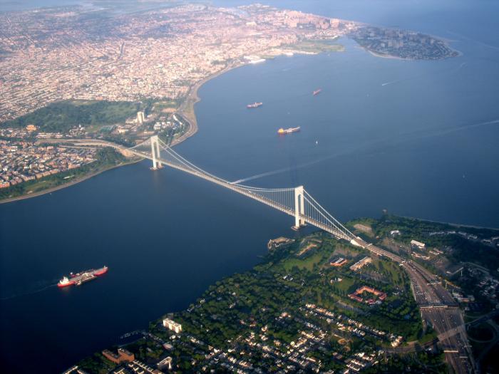
Located at the mouth of upper New York Bay, the bridge not only connects Brooklyn with Staten Island but is also a major link in the interstate highway system, providing the shortest route between the middle Atlantic states and Long Island.
In Brooklyn, the bridge connects to the Belt Parkway and the Brooklyn-Queens Expressway and to the largely residential community of Bay Ridge. On Staten Island, which saw rapid development after the bridge opened in 1964, it joins the Staten Island Expressway, providing access to the many communities in this most rural of the city's five boroughs.
Taken from the Metropolitan Transportation Authority: www.mta.info/bandt/html/veraz.htm
The bridge furnishes a critical link in the local and regional highway system. It is the starting point of the New York City Marathon. The bridge marks the gateway to New York Harbor; all cruise ships and most container ships arriving at the Port of New York and New Jersey must pass underneath the bridge and thus must be built to accommodate the clearance under the bridge.
The bridge was the last great public works project in New York City overseen by Robert Moses, the New York State Parks Commissioner and head of the Triborough Bridge and Tunnel Authority.
Among local residents, it is often referred to as simply "the Verrazano".
Its monumental 693 foot high towers are 1 5/8 inches farther apart at their tops than at their bases because the 4,260 foot distance between them made it necessary to compensate for the earth's curvature. Each tower weighs 27,000 tons and is held together with three million rivets and one million bolts. Seasonal contractions and expansions of the steel cables cause the double-decked roadway to be 12 feet lower in the summer than in the winter.
Located at the mouth of upper New York Bay, the bridge not only connects Brooklyn with Staten Island but is also a major link in the interstate highway system, providing the shortest route between the middle Atlantic states and Long Island.
In Brooklyn, the bridge connects to the Belt Parkway and the Brooklyn-Queens Expressway and to the largely residential community of Bay Ridge. On Staten Island, which saw rapid development after the bridge opened in 1964, it joins the Staten Island Expressway, providing access to the many communities in this most rural of the city's five boroughs.
Taken from the Metropolitan Transportation Authority: www.mta.info/bandt/html/veraz.htm
Wikipedia article: http://en.wikipedia.org/wiki/Verrazano-Narrows_Bridge
Nearby cities:
Coordinates: 40°36'22"N 74°2'43"W
- The Williamsburg Bridge 13 km
- Ben Franklin Bridge 118 km
- Île d'Orléans Bridge 736 km
- Ambassador Bridge 777 km
- Mackinac Bridge 1044 km
- Atlantic Bridge 3532 km
- Angostura Bridge 3758 km
- Tacoma Narrows Bridge 3894 km
- San Francisco-Oakland Bay Bridge 4129 km
- Severn Bridge 5415 km
- "The Narrows" 1.7 km
- Dyker Heights 2.6 km
- Bath Beach 3.9 km
- Bensonhurst 4.4 km
- Coney Island 5.9 km
- Coney Island (Peninsula) 7 km
- Lower New York Bay 7.5 km
- Staten Island 10 km
- Brooklyn 10 km
- Queens 15 km
Comments