Kourion
Cyprus /
Government controlled area /
Kantou /
World
/ Cyprus
/ Government controlled area
/ Kantou
World / Cyprus
ancient, archaeological site, acropolis, open air museum, interesting place


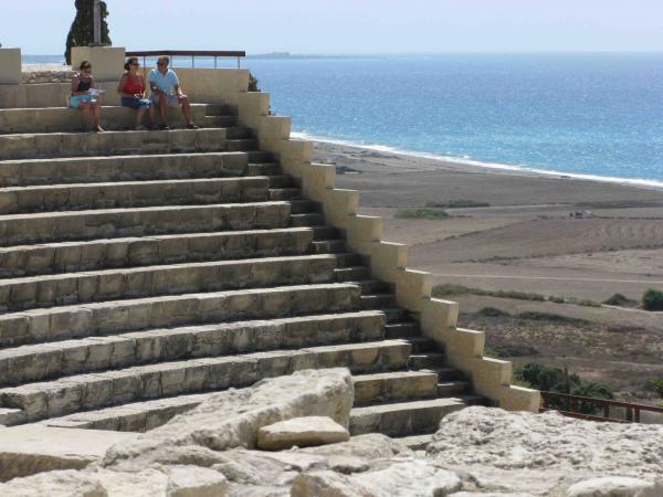
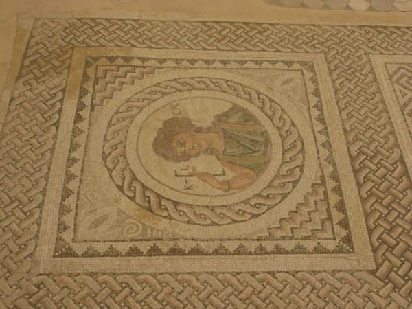


The mount of Kourion, on which the ancient city-kingdom developed, occupies a dominant position on the coast 4 km southwest of the village of Episkopi in the Lemesos district. The earliest evidence of settlement in the broader area of Kourion dates to the Neolithic period (4500-3900 B.C.), whilst the most ancient remains in the area of the ancient city itself are connected with settlements and tombs of the Middle and Late Bronze Age. According to tradition Kourion was founded by Argives in the 13th century BC, during the first wave of the Mycenaean expansion and others followed the Argives in the 12th century as a result of the Dorian invasion of Greece.
Wikipedia article: http://en.wikipedia.org/wiki/Kourion
Nearby cities:
Coordinates: 34°39'55"N 32°53'10"E
- Acropolis 316 km
- Monte Smith park / Acropolis of Rhodes 468 km
- Acropolis of Samos 633 km
- Cadmea 948 km
- Acropolis 973 km
- Acropolis of ancient Sparta 981 km
- Steiris 996 km
- Atrax Acropolis 1095 km
- Palairos Acropolis 1171 km
- Ancient Palairos 1171 km
- Windsurfing Spot 1.5 km
- Courion Kite-surfing spot 2.1 km
- Kouris Delta 2.5 km
- RAF Akrotiri Western Sovereign Bases Area (of UK) 3.6 km
- Akrotiri Aerial Farm 7.4 km
- Episkopi Bay 7.8 km
- Limassol Salt Lake 9 km
- Kato Polemida Municipality 10 km
- Royal Air Force (RAF) Akrotiri 13 km
- Limassol District 13 km