Porta Nigra (Trier)
Germany /
Rheinland-Pfalz /
Trier /
Porta-Nigra-Platz
World
/ Germany
/ Rheinland-Pfalz
/ Trier
World / Germany / Rheinland-Pfalz / Trier
gate, Roman Empire, UNESCO World Heritage Site, listed building / architectural heritage
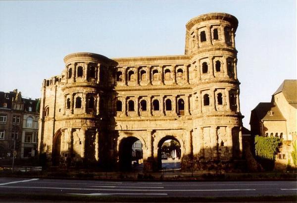
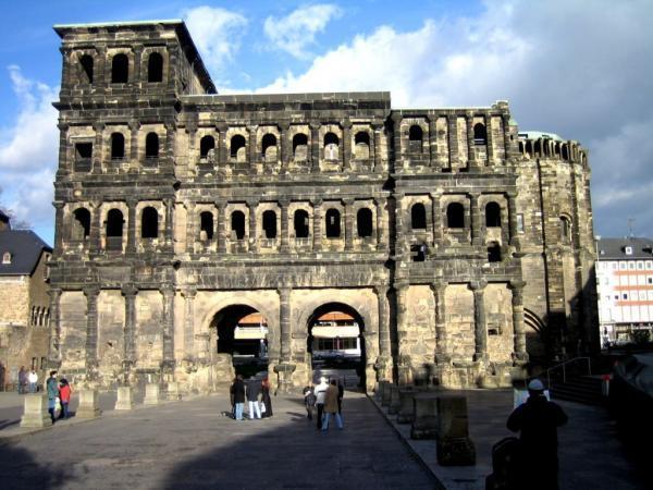
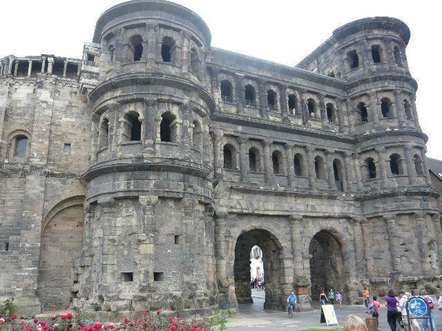
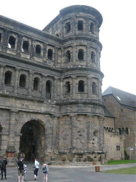
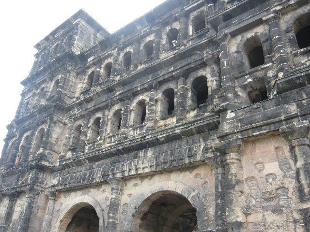
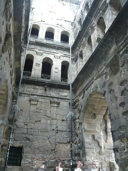
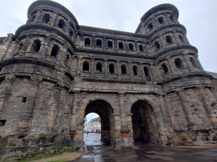
The gate dates back to a time (about A.D. 180) when the Romans often erected public buildings of huge stone blocks (here, the biggest weigh up to six metric tons). The slabs were cut by bronze saws powered by mill wheels (some cutting traces are still visible) and put together without mortar. Instead, two stones each were held together horizontally by iron clamps whose bent ends were embedded in corresponding holes by molten lead. www.trier-info.de
www.bing.com/maps/default.aspx?v=2&cp=49.759592~6.64394...
www.bing.com/maps/default.aspx?v=2&cp=49.759592~6.64394...
Wikipedia article: http://en.wikipedia.org/wiki/Porta_Nigra
Nearby cities:
Coordinates: 49°45'34"N 6°38'38"E
- Main Gate 25 km
- Former Back Gate to Hahn Air Force Base 51 km
- Germans' Gate 79 km
- Stargate (Sterntor) 113 km
- Ponttor 121 km
- Severinstor 131 km
- Eigelstein Gate Tower 134 km
- Middle Gate 212 km
- Kobolzell Gate 259 km
- Entrance Gate (KZ Buchenwald) 356 km
- Palace Garden - Palastgarten 0.9 km
- Site of Trier´s roman circus 1 km
- Kaiserthermen (Emperor's Baths/ Imperial Baths) 1.1 km
- Amphitheater Trier 1.3 km
- Barbara Baths 1.5 km
- Hela Profi Zentrum 1.8 km
- Supermarket Ratio 2 km
- St. Matthias Abbey 2.6 km
- University of Trier Campus 2 2.6 km
- Japan Tobacco International 4.7 km