Hirbat al-Dayr (Al Fuheis)
Jordan /
al-Balqa /
al-Fuhhays /
Al Fuheis
World
/ Jordan
/ al-Balqa
/ al-Fuhhays
, 3 km from center (الفحيص)
World / Jordan / Balqa
archaeological site
Add category
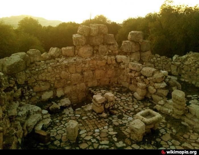
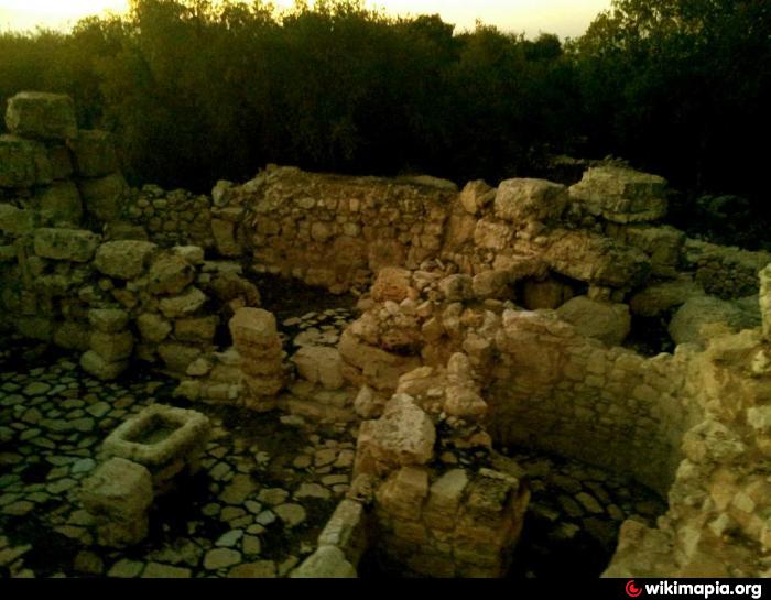
Khirbat al–Dayr is located 2.5 km south east of Fuheis, north east in the region of the Ketef al–Ghawr (Shoulder of the Depression) which in the Roman period was on the border line between the Jewish Perea and the territory of Philadelphia-Amman of the Despoils and in the Byzantine period between the territory of the dioceses of Gadara–es-Salt and Philadelphia–Amman. In the Islamic period it was part of the Balqa region. The archaeological excavation carried on by the Department of Antiquaties under the direction of Mr.Sa’ad al–Hadidi, inspector of Es-Salt, lasted from September to December 2002 ,and have been resumed in the year 2003-2009. The excavations focused on the huge tower which dominates the summit of the mountain at 1030 m. related to the iron age period. The tower was used in the Byzantine period as a church, the church was divided into a nave and an aisle to the north both covered by arches stretching in a north–south direction. Two doors on the northern wall opened into two small rooms. In the floor of the western room there was the opening of an underground water cistern, while the eastern room was leaned against a water cistern identified by the waterproof mortar built in the corner inside the church عاصم عصفور
Nearby cities:
Coordinates: 31°59'43"N 35°47'40"E
- Mahanaim - Tulul adh-Dhahab 24 km
- Horbat Humsa 39 km
- Horbat Atuf 46 km
- Khirbet Qalisa 55 km
- Old City 64 km
- Khirbat al-Jawfa 65 km
- Sabastiyah 65 km
- Shomron 66 km
- Har Barqan 68 km
- Har Shaul 73 km
- مزرعة اردينى ويوسف صويص 0.5 km
- Plot for sale Plot 250 0.6 km
- Amman Baccalaureate School (ABS) 1.1 km
- Alferdaous Citty 1.6 km
- Dabouq 1.7 km
- Manaseer Palace 2 km
- Royal palaces metropolitan 2.9 km
- Sweileh 3.1 km
- Sweileh 3.6 km
- Al Balqa governorate 4.9 km
Comments