Jubilee Bridge (Nuneaton)
United Kingdom /
England /
Nuneaton
World
/ United Kingdom
/ England
/ Nuneaton
World / United Kingdom / England
footbridge, bridge
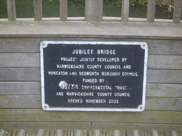


Was a project jointly developed by Warwickshire county council and Nuneaton & Bedworth Borough council. Funded by SITA environmental trust & Warwickshire county council, opened November 2002.
Nearby cities:
Coordinates: 52°31'18"N 1°27'59"W
- Coton Arches 0.8 km
- Hilltop Footbridge 1.1 km
- Pauls Land Railway Footbridge 2.3 km
- Railway Bridge LEC2/53 5 km
- Hermitage Bridge 16 km
- Newton Lane Bridge 17 km
- Shuttington Bridge 18 km
- Bolebridge Viaduct 19 km
- Hopwas Bridge 23 km
- Rail Bridge over the River Tame 23 km
- Nuneaton Town Centre 0.1 km
- The Ropewalk Shopping Centre 0.2 km
- Riversley Park 0.4 km
- Abbey Street Car Park 0.4 km
- The Parade 0.4 km
- Abbey 0.7 km
- St Nicolas 1.7 km
- Wem Brook 1.8 km
- Chilvers Coton 3.1 km
- Warwickshire 24 km
Comments