SEPTA Fern Rock Transportation Center (Philadelphia, Pennsylvania)
USA /
Pennsylvania /
Philadelphia /
Philadelphia, Pennsylvania
World
/ USA
/ Pennsylvania
/ Philadelphia
World / United States / Pennsylvania
Southeastern Pennsylvania Transportation Authority (SEPTA), train station, bus station, metro station


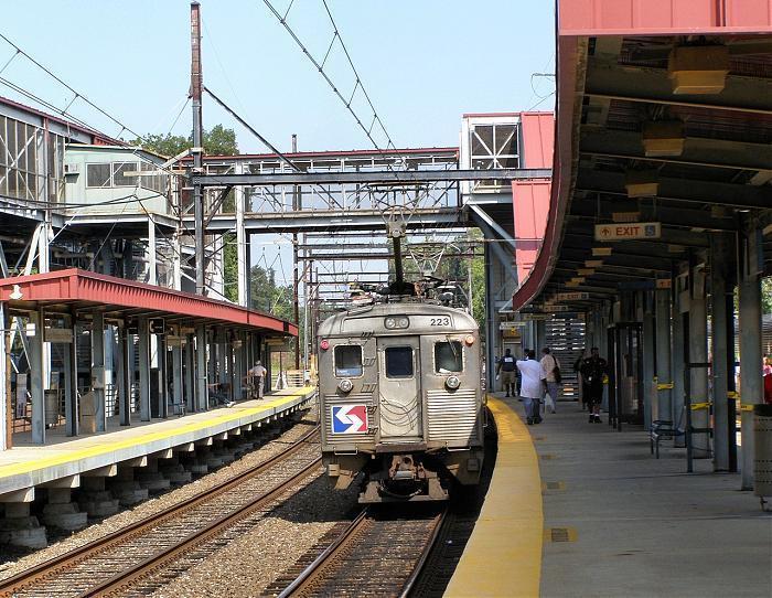


This includes the northern terminus of SEPTA's Broad Street Subway (Orange Line), Regional Rail Station, and terminus for many bus routes. The Regional Rail Station is part of the old Reading Railroad "Main Line." There was an old Fern Rock Station, just north of the Transportation Center, that was closed when the Fern Rock TC was opened in 1992.
Wikipedia article: http://en.wikipedia.org/wiki/Fern_Rock_Transportation_Center_(SEPTA_station)
Nearby cities:
Coordinates: 40°2'26"N 75°8'12"W
- Frankford Transportation Center 5.1 km
- Only IND Elevated Section 120 km
- Chambers Street/World Trade Center/Park Place Subway Station (2,3,A,C,E) 121 km
- Fulton Street Subway Station (2,3,4,5,A,C,J,Z) 121 km
- 14th Street / Union Square Subway Station (4,5,6,<6>,L,N,Q,R) 124 km
- Times Square – 42nd Street Subway Station (1,2,3,7,<7>,N,Q,R,S) 126 km
- Grand Central - 42nd Street Subway Station (4,5,6<6>7<7>S) 126 km
- Broadway Junction Station (New York City Subway) - ( Services : A, C, J, L, Z ) 126 km
- Hammels Wye 128 km
- Kawasaki Rail car 145 km
- Fern Rock 0.3 km
- Olney 1 km
- East Oak Lane 1.6 km
- Logan Redevelopment Area 2 km
- Hunting Park 2.7 km
- Greenmount Cemetery 2.9 km
- Friends Hospital 3.3 km
- Juniata Park - Feltonville 3.5 km
- Juniata Golf Course 3.9 km
- Montgomery County, Pennsylvania 27 km