Beatrix Gold Mine
South Africa /
Free State /
Virginia /
World
/ South Africa
/ Free State
/ Virginia
World / South Africa / Orange Free State
mine, production
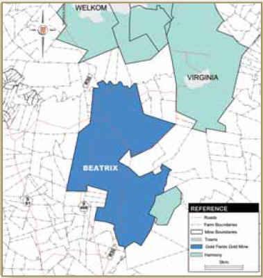
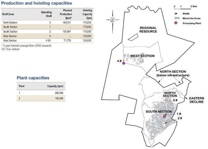
Located some 240 kilometers south-west of Johannesburg, near the towns of Welkom and Virginia in the Free State province, the Beatrix Gold Mine is the only one of Gold Fields’ mines in South Africa which is located on the southern rim of the Witwatersrand Basin. Beatrix has 17.1 million ounces in Mineral Resources and 5.7 million ounces in Mineral Reserves. Beatrix is a large shallow to medium depth gold mine operating at depths of between 700 meters and 2,200 meters below surface. Geologically the mine is located along the southern rim of the Witwatersrand Basin and exploits auriferous palaeoplacers (reefs) of the Central Rand Group. The Beatrix Reef (BXR), and local facies variations thereof, constitutes 72 per cent of the Beatrix Mineral Reserve, with the Kalkoenkrans Reef (KKR) contributing 28 per cent. The mine consists of four producing shafts and two processing plants, of which 1 Plant processes only underground ore and 2 Plant surface material only.
Reference for information:
www.goldfields.co.za/ops_beatrix.php
Reference for information:
www.goldfields.co.za/ops_beatrix.php
Nearby cities:
Coordinates: 28°12'26"S 26°45'41"E
- Masimong Gold Mine (Masimong 5) 30 km
- Target Gold Mine 63 km
- Letsedi Solar Field PV Project 114 km
- Redstone Solar Thermal Power 334 km
- Jasper Solar Energy Project 335 km
- Dorper Wind Farm 364 km
- Lohatlha Manganese Mine 367 km
- Noupoort Wind farm 370 km
- De Aar MS Solar Field 376 km
- Sishen Solar Field 384 km
- WITS GOLD - Debron Merriespruit Project 13 km
- Virginia Operations - Merriespruit 1 17 km
- St. Helena Gold Mine 18 km
- Welkom Gold Mine 30 km
- Freddies Consolidated Mines Limited 33 km
- Phakisa Gold Mine 35 km
- Jeanette Gold Project 48 km
- Hilton Gold Project 48 km
- Vredefort impact crater 145 km
- Vaal Dam (man-made lake) 201 km