Grenadier Pond
Canada /
Ontario /
Toronto /
World
/ Canada
/ Ontario
/ Toronto
World / United States / New York
lake, pond
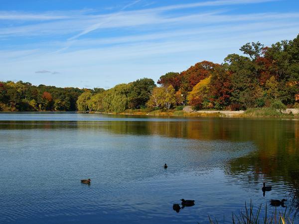
Grenadier Pond, is a large body of water (14.2 hectares (35 acres)) located on the western edge of the park. It is named after the local Town of York garrison of the 1800s and their use of the pond for fishing. There are two local myths circulating about the Pond. One is that British Grenadiers fell through its thin ice when crossing to defend the city in the War of 1812. Other myths include that the pond is 'bottomless', that is, its depth cannot be measured due to the amount of mud. Fishing remains a popular pastime. Largemouth bass, black crappie, yellow perch, pumpkinseed, bluegill, brown bullhead and carp sport fish are present in the pond. Fish caught in the pond are safe to eat, and fishing derbies and casting contests have been held there.
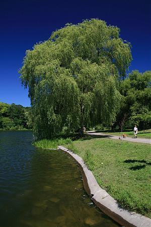
Initiatives have been made to improve the Pond's health and environment. Grenadier Pond receives some of its water from Wendigo Creek, Wendigo Pond and underground streams feeding it from the north. The northern end of the Pond was naturalized, building a wetland to filter the waters the Pond receives from the stream. The southern and south-western shore of the Pond was also naturalized, removing the manicured lawn and concrete bank to improve the Pond's health and discourage Canada geese. Signs now ask people not to feed the waterfowl. Grenadier Pond is home to multiple species of bird and marsh wildlife.
Wendigo Creek, Wendigo Pond and Wendigo Way are likely named after the wendigo, mythical cannibalistic creatures of Algonquian mythology. Algonquins did not have a settlement in the park, but are believed to have used it for hunting and fishing and cultivating corn on the sandy uplands of the park.[7]
Wikipedia article: http://en.wikipedia.org/wiki/High_Park
Nearby cities:
Coordinates: 43°38'33"N 79°27'59"W
- Swimming Quarry 54 km
- 3rd Welland Canal Lake 61 km
- 40th Street Pond 255 km
- East Cranberry Pond 310 km
- Lake Pond 311 km
- West Cranberry Pond 311 km
- Sanctuary Pond 312 km
- Girardinn Pond 312 km
- Foote Dam Pond on the Au Sable River 335 km
- Stoneco Quarry 403 km
- Hillside Gardens 0.1 km
- Cherry Trees 0.2 km
- High Park 0.5 km
- Rennie Park 0.5 km
- Sunnyside Beaches 1 km
- Palace Pier & Palace Point 1.4 km
- Roncesvalles (Little Poland) 1.4 km
- Humber Shores Park 1.8 km
- Humber Bay 2.3 km
- Lake Ontario 121 km