Jižní Město (Southern Town) (Prague)
Czech Republic /
Stredocesky /
Vestec /
Prague
World
/ Czech Republic
/ Stredocesky
/ Vestec
World / Czech Republic / Prague
borough, prefabricated building, public housing estate


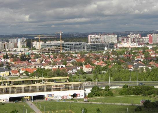

Jižní Město is big area in Prague with approximately 85,000 inhabitants on 10 km2. It is located 12 kilometers far from city center in southeast direction. It consist of two boroughs, Chodov (Chodov, Opatov, Litochleby, Roztyly, Chodovec) and smaller Háje. Also small parts of Kunratice (Flora) and Újezd (Kateřinky) can be found here. In 70's and 80's number of inhabitants got multiplied by thirty, because of notourius prefabs ("panelák") built during comunism. Main traffic stream provided by metro line C and highway D1. Area of Jižní Město isn't exactly identified, but it almost agrees with Prague 11.
Wikipedia article: http://en.wikipedia.org/wiki/Jižní_Město
Nearby cities:
Coordinates: 50°1'49"N 14°30'37"E
- London Borough of Havering 1024 km
- London Borough of Bexley 1028 km
- London Borough of Bromley 1038 km
- Malynovskyi District 1253 km
- Central district 1319 km
- Shevchenkovskyi Raion (Shevchenko district) 1523 km
- Petrovsky district 1689 km
- Kirovskyi district 1694 km
- Artemivskyi District 1788 km
- Zhovtnevyi District 1796 km
- Central Park 0.4 km
- Soviet war memorial cemetery of the fallen for the liberation of Prague from the Nazis 0.5 km
- Donovalska Home for Elderly People 0.7 km
- Chodov 0.8 km
- Chodov natural amphitheatre 1 km
- Modrá Škola,Jižní město,Praha 11,Háje. "Modra Skola",Jizni mesto,Prague 11,Haje. 1 km
- Hostivařský les (Hostivař Forest) 2.1 km
- Prague 10 3.3 km
- Městský okruh (City Ring) - MO 5.6 km
- Metro - Line C 5.8 km
Central Park
Soviet war memorial cemetery of the fallen for the liberation of Prague from the Nazis
Donovalska Home for Elderly People
Chodov
Chodov natural amphitheatre
Modrá Škola,Jižní město,Praha 11,Háje. "Modra Skola",Jizni mesto,Prague 11,Haje.
Hostivařský les (Hostivař Forest)
Prague 10
Městský okruh (City Ring) - MO
Metro - Line C