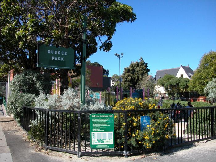
Duboce Park (San Francisco, California)
USA /
California /
San Francisco /
San Francisco, California
World
/ USA
/ California
/ San Francisco
World / United States / California
park
Add category
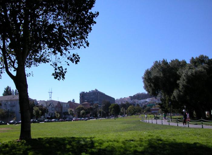
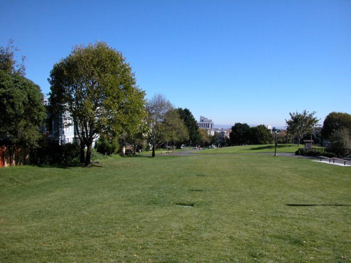
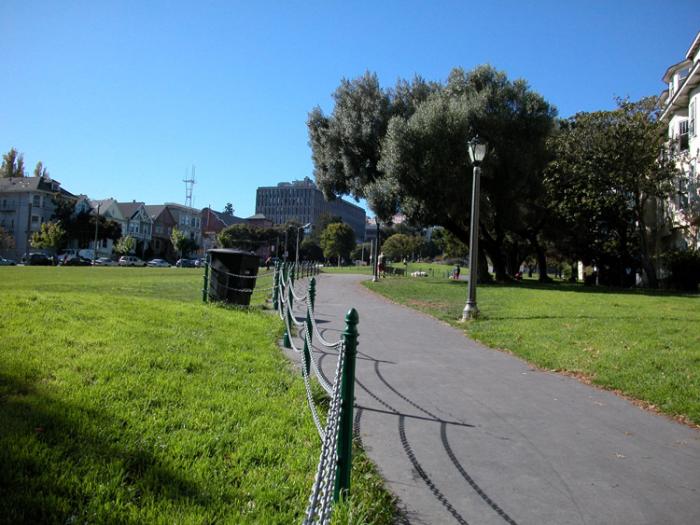
Duboce Park ("Duboce" is pronounced Duh-BOH-ss) is a small park between the Duboce Triangle and Lower Haight neighborhoods of San Francisco, California. The N Judah Muni Metro streetcar line runs along Duboce Avenue, which forms the southern boundary of the park. The park is less than one block wide from north to south, and two blocks wide from west to east. Its western boundary is Scott Street and its eastern boundary is Steiner Street.
The streetcar tracks depart from Duboce Avenue at the western end of the park to enter the Sunset Tunnel.
The park is a popular site for dog walkers, and has a fence-enclosed area with a children's play structure. Behind the play area (to the west) is a fenced-in basketball court with multiple rims.
Along the west end of the park (along Scott Street) is the Harvey Milk Recreational Arts Building, which hosts a number of community events and includes a photography center, a studio for dance and aerobics classes and a Midnight Music Program. In addition, the Friends of Duboce Park host an Annual Film Festival, featuring movies filmed in San Francisco, in the photography center.
Wikipedia article: http://en.wikipedia.org/wiki/Duboce_Park
Nearby cities:
Coordinates: 37°46'11"N 122°26'0"W
- Muir Woods National Monument 22 km
- Mount Tamalpais State Park 24 km
- Bolinas Lagoon 30 km
- Mount Tamalpais Watershed 37 km
- Samuel P. Taylor State Park 41 km
- Olompali Ranch Historic Park 48 km
- Drake's Estero 58 km
- Tomales Bay State Park 59 km
- Tomales Point 72 km
- Point Reyes National Seashore 74 km
- Lower Haight 0.2 km
- Castro District 0.7 km
- Haight-Ashbury 1 km
- Eureka Valley 1 km
- Western Addition 1.1 km
- Twin Peaks 2.3 km
- Parnassus Heights 2.3 km
- Noe Valley 2.4 km
- Inner Sunset 3.1 km
- San Francisco Bay 15 km