Walney Island Lighthouse TP9854
United Kingdom /
England /
Isle of Walney /
World
/ United Kingdom
/ England
/ Isle of Walney
World / United Kingdom / England
lighthouse, triangulation station, interesting place
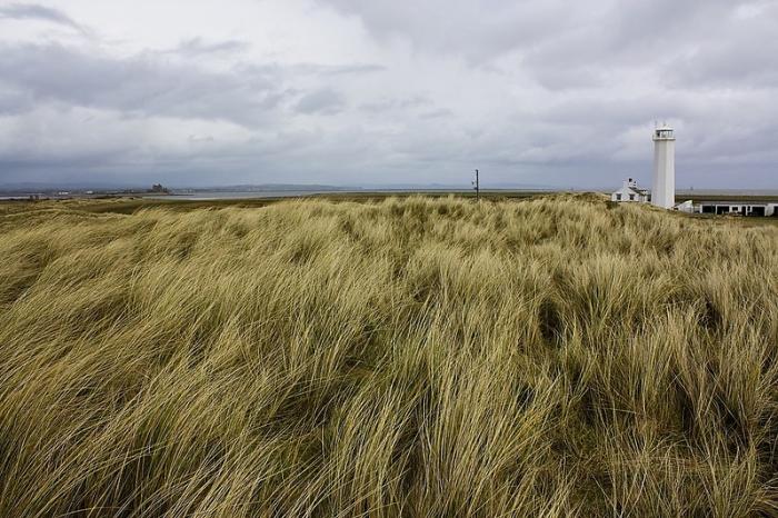
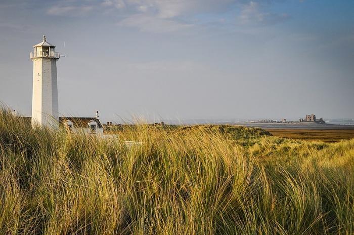
During 1789 ‘Lancaster merchants’ petitioned Parliament and were successful in having leave granted to them in order to construct a lighthouse on the south-end peninsula of Walney-Island at Haws Point, adjacent to the 'high water mark'. It gives an understanding to the amount of land now re-deposited at the site as the lighthouse is now completely surrounded by land.
Funds for the lighthouse’s construction were gained by charges imposed on vessels using neighbouring ports of Glasson. It was because of Glasson’s dock system that the lighthouse was constructed in the first place and not for the benefit Barrow-in-Furness, as we would believe today. It’s secondary function was to improve ‘River Lune’ navigation, hence the charges made to other shipping in the area.
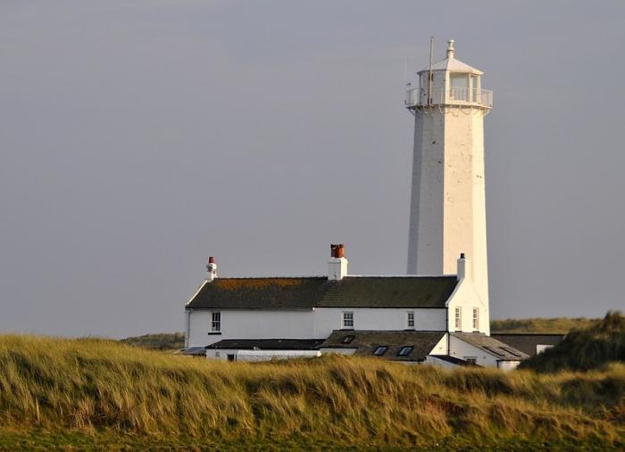
First use of Walney’s newly constructed lighthouse, a wooden structure with an oil / paraffin lamp took place in late 1790. It wasn’t long before improvements were made, the first coming only after one year of use in 1791 with the incorporation of a new clockwork ‘revolving’ system. During 1803 disaster struck, the lantern caught fire and the wooden structure was raised to the ground.
www.walney-island.com/walney_lighthouse_01.htm
A triangulation station, coded TP9854: www.trigpointinguk.com/trigs/trig-details.php?t=9854
Funds for the lighthouse’s construction were gained by charges imposed on vessels using neighbouring ports of Glasson. It was because of Glasson’s dock system that the lighthouse was constructed in the first place and not for the benefit Barrow-in-Furness, as we would believe today. It’s secondary function was to improve ‘River Lune’ navigation, hence the charges made to other shipping in the area.
First use of Walney’s newly constructed lighthouse, a wooden structure with an oil / paraffin lamp took place in late 1790. It wasn’t long before improvements were made, the first coming only after one year of use in 1791 with the incorporation of a new clockwork ‘revolving’ system. During 1803 disaster struck, the lantern caught fire and the wooden structure was raised to the ground.
www.walney-island.com/walney_lighthouse_01.htm
A triangulation station, coded TP9854: www.trigpointinguk.com/trigs/trig-details.php?t=9854
Nearby cities:
Coordinates: 54°2'54"N 3°10'37"W
- Antony Gormley's Another Place 61 km
- Tuebrook and Stoneycroft 70 km
- Port Sunlight 77 km
- The Great Orme / Y Gogarth 91 km
- Denbigh Moors 108 km
- Dinorwig slate quarries (disused) 119 km
- Llangollen 119 km
- Abermenai Point 128 km
- Aberdyfi 177 km
- Borth Bog / Cors Fochno 180 km
- Barrow in Furness Gas Terminals 5.3 km
- Ramsden Dock 6.3 km
- Walney Island 6.3 km
- Cavendish Dock Reservoir 6.5 km
- Port of Barrow 6.6 km
- BAE Systems Submarine Solutions 7.3 km
- Furness Golf Club 9 km
- Walney Airport 10 km
- Sandscale Haws 13 km
- Morecambe Bay 15 km