Dinawan Island
Malaysia /
Sabah /
Kinarut /
World
/ Malaysia
/ Sabah
/ Kinarut
World / Malaysia / Sabah
island
Add category
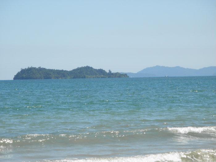
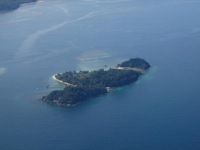
This island was believed to be Dinawan Hill, which was located at the mouth of Kinarut River before it became an island. Those sitting on the left side of the plane upon landing at the airport will get to see this island.
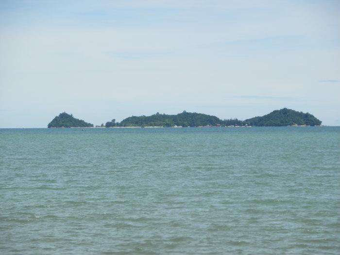
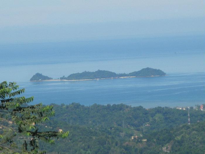
The most obvious feature of this island is that it appears as three islets when viewed either from the west, or east. The eastern-most point of the island is named Flagstaff Point while the NE point is named Costello Point.
The most obvious feature of this island is that it appears as three islets when viewed either from the west, or east. The eastern-most point of the island is named Flagstaff Point while the NE point is named Costello Point.
Nearby cities:
Coordinates: 5°50'50"N 115°59'26"E
- Pulau Jambongan 179 km
- Balambangan Island 193 km
- Malawali Island 197 km
- Banggi Island 206 km
- Pulau Timbang 213 km
- Balabac Island, Palawan 270 km
- Jackson Reef 524 km
- Tizard Bank 548 km
- Spratly Islands 558 km
- Kalayaan 621 km
- Everett Reef 0.7 km
- Kinarut Palm Beach Villa 3.9 km
- Sabah Meat Technology Centre 4.6 km
- Plants Station 4.9 km
- Kinarut Outward Bound School 5 km
- Pusat Latihan Kecemerlangan Koperasi (PULAKOP) 5.7 km
- Maktab Rendah Sains Mara Kota Kinabalu 5.9 km
- 16th Battalion Headquarters 6 km
- Tunku Abdul Rahman National Park 17 km
- Papar District 28 km
Comments