Tenzing-Hillary Airport (Lukla)
Nepal /
Sankhuwasabha /
Khandbari /
Lukla
World
/ Nepal
/ Sankhuwasabha
/ Khandbari
World / Nepal / East / Sagarmatha / Solukhumbu
airport
Add category


IATA: LUA, ICAO: VNLK
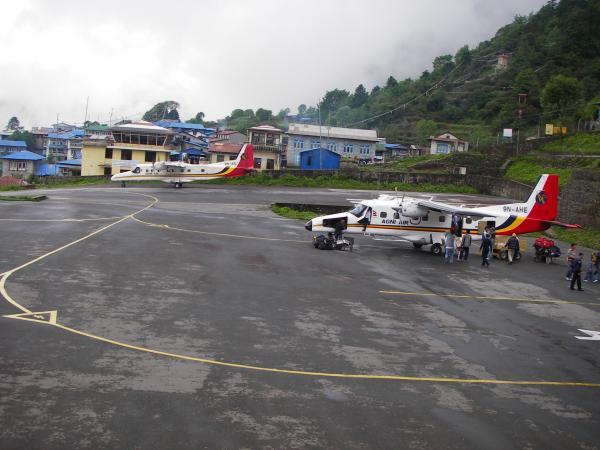
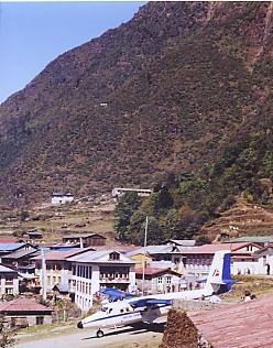
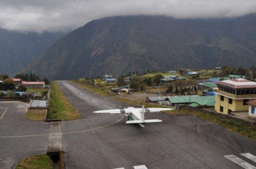
Lukla Airport is a small airport in the Town of Lukla in Khumbu, eastern Nepal. In January 2008, the government of Nepal announced that the airport would be renamed in honor of Sir Edmund Hillary and Sherpa Tenzing Norgay, the first persons to reach the summit of Mount Everest. The airport is now officially named Tenzing-Hillary Airport.
The airport was built for the climber of Mount Everest. Aviation can only be done during the day when the weather is sunny; But when the wind blows hard and the sky is cloudy, the airport will be closed to all flights.
It has a runway length of 460 meters and a width of 20 meters, there is no reason for the pilot to make a mistake during takeoff or landing. Because the foundation having a tilt at the end and directly across the valley. The tilt/slope is up to 12 degrees.
From 1973 to 2010 there have been nine plane crashes at the airport.
Location
City: Lukla, Nepal
Details
Use: Public/Civil
Latitude: 27°41'16"N
Longitude: 86°43'53"E
Elevation: 9100 ft (2774 m)
Runways: 1
Longest: 1500 ft (457 m)
Farthest: SCFX: 11628 mi / 18714 km, Isla San Felix, CLHillary
Wikipedia article: http://en.wikipedia.org/wiki/Tenzing-Hillary_Airport
Nearby cities:
Coordinates: 27°41'12"N 86°43'46"E
- Pakyong 189 km
- Hasimara Air Force Station 281 km
- Gorakhpur Airport / Airforce Station (AFS) 343 km
- Andal Airport (AAI) 453 km
- Lal Bahadur Shashtri International Airport, Babatpur, Varanasi (U.P.) 459 km
- Chakulia Airfield Area WW2 580 km
- Netaji Subhas Chandra Bose International Airport 583 km
- Kalaikunda Air Force Station 595 km
- Trishul Air base - Bareilly Airport / Airforce Station 722 km
- Saifai Airstrip 764 km
- Likhu Glacier 21 km
- Sagarmatha National Park (Khumbu) 28 km
- Tolam Bau Galcier 29 km
- Khumbu Glacier 33 km
- Ngojumba Glacier 33 km
- Chhule Glacier 35 km
- Lunag Glacier 38 km
- Lumsumna Glacier 39 km
- Pangbuk Glacier 39 km
- Gaurishankar Conservation Area 61 km
Comments