Santa
Philippines /
Ilocos /
Caoayan /
World
/ Philippines
/ Ilocos
/ Caoayan
World / Philippines / Ilocos Sur / Santa
town, municipality, third-level administrative division, do not draw title
Municipality of Santa, Province of Ilocos Sur
ZIP code: 2703
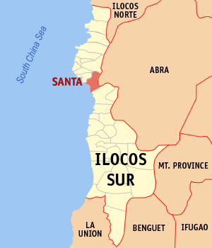
Santa is a coastal municipality in the province of Ilocos Sur in the Philippines. It had a population of 15,106 people as registered in the 2010 Census. The town is geographically situated in the central part of the province.
Santa is administratively subdivided into 26 barangays:
-Ampandula
-Banaoang
-Basug
-Bucalag
-Cabangaran
-Calungboyan
-Casiber
-Dammay
-Labut Norte
-Labut Sur
-Mabilbila Norte
-Mabilbila Sur
-Magsaysay District (Poblacion)
-Manueva
-Marcos (Poblacion)
-Nagpanaoan
-Namalangan
-Oribi
-Pasungol
-Quezon (Poblacion)
-Quirino (Poblacion)
-Rancho
-Rizal
-Sacuyya Norte
-Sacuyya Sur
-Tabucolan
ZIP code: 2703
Santa is a coastal municipality in the province of Ilocos Sur in the Philippines. It had a population of 15,106 people as registered in the 2010 Census. The town is geographically situated in the central part of the province.
Santa is administratively subdivided into 26 barangays:
-Ampandula
-Banaoang
-Basug
-Bucalag
-Cabangaran
-Calungboyan
-Casiber
-Dammay
-Labut Norte
-Labut Sur
-Mabilbila Norte
-Mabilbila Sur
-Magsaysay District (Poblacion)
-Manueva
-Marcos (Poblacion)
-Nagpanaoan
-Namalangan
-Oribi
-Pasungol
-Quezon (Poblacion)
-Quirino (Poblacion)
-Rancho
-Rizal
-Sacuyya Norte
-Sacuyya Sur
-Tabucolan
Wikipedia article: http://en.wikipedia.org/wiki/Santa,_Ilocos_Sur
Nearby cities:
Coordinates: 17°30'39"N 120°26'12"E
- Tineg 59 km
- Nueva Era 77 km
- Conner 83 km
- Kabugao 95 km
- Calanasan 126 km
- Lal-lo 143 km
- Peñablanca 144 km
- Echague 148 km
- San Mariano 170 km
- Dinapigue 188 km
- Magsaysay 2.4 km
- Northern Luzon Heroes Hill National Park 3.2 km
- Mt. Tirad 3.4 km
- Mt. Gusing 3.4 km
- Poro Island 3.5 km
- South Tetas de Santa 3.7 km
- Cabaruyan 4.6 km
- Carsuan 5.3 km
- Kakaldingan 5.9 km
- Ilocos Sur 30 km
Comments