Antipodes Islands
New Zealand /
Canterbury /
Akaroa /
World
/ New Zealand
/ Canterbury
/ Akaroa
World / New Zealand / Otago / Antipodes Islands
island
Add category
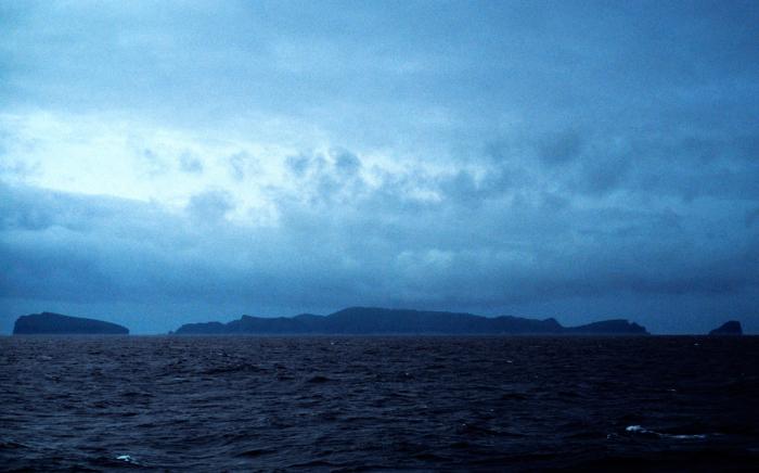


The Antipodes Islands are inhospitable volcanic islands to the south of (and territorially part of) New Zealand. They lie 860 kilometres to the southeast of Stewart Island/Rakiura. The group consists of one main island, Antipodes Island, of 20 km² area, Bollons Island of 2 km² to the north, and numerous small islets and stacks. The highest point is Mount Galloway (402 m)
ortho.linz.govt.nz/nz_offshore_islands/antipodes_high_r...
ortho.linz.govt.nz/nz_offshore_islands/antipodes_high_r...
Wikipedia article: http://en.wikipedia.org/wiki/Antipodes_Islands
Nearby cities:
Coordinates: 49°41'10"S 178°46'12"E
- Campbell Island, New Zealand 749 km
- Stewart Island/Rakiura 890 km
- Auckland Islands 925 km
- Arapawa Island 1022 km
- Resolution Island, New Zealand 1028 km
- South Island (New Zealand) 1406 km
- Macquarie Island 1462 km
- Young Island 2070 km
- Bruny Island 2521 km
- Tasmania 2839 km
- Mt. Galloway 0.7 km
- Mount Waterhouse, Antipodes Island 1 km
- Castaway shed 3.5 km
- Cossack Rock 735 km
- Bull Rock 735 km
- Meteorological station at Beeman Cove 743 km
- World's Loneliest Tree 744 km
- Southernmost Point of New Zealand 748 km
- Seagull Rock 751 km
- Hook Keys 753 km