Hawaii Tracking Station (HTS), HULA
USA /
Hawaii /
Makaha /
World
/ USA
/ Hawaii
/ Makaha
World / United States / Hawaii
military
Add category
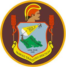
This portion of HULA, the original built in 1959 as one of three tracking stations built that year, is closed.
Wikipedia article: http://en.wikipedia.org/wiki/Kaena_Point_Satellite_Tracking_Station
Nearby cities:
Coordinates: 21°34'19"N 158°16'0"W
- Makua Military Reservation 3.8 km
- Schofield Barracks Military Reservation 14 km
- Naval Magazine Pearl Harbor (a.k.a. Naval Magazine Lualualei) 16 km
- Kawailoa Military Training Area 25 km
- East Range Military Training Area 26 km
- Ewa Forest Reserve - Poamoho Section/Poamoho Training Area 28 km
- Former Naval Air Station Barbers Point 33 km
- Pearl Harbor 35 km
- Joint Base Pearl Harbor – Hickam (IATA: HIK – ICAO: PHIK) 38 km
- Fort Shafter 44 km
- Kuaokalā Game Management Area 3.3 km
- Ka'ena Point State Park 3.5 km
- Dillingham Airfield 7.2 km
- Dillingham Ranch 8.3 km
- Makua Keaau Forest Reserve 10 km
- Mokulēʻia Forest Reserve 11 km
- Makaha Golf Club West 12 km
- Oʻahu 33 km
- Wai'anae Slump 42 km
- Kaʻieʻie Waho Channel 53 km