Chapo Lake (Chile)
Chile /
Los Lagos /
Puerto Montt /
World
/ Chile
/ Los Lagos
/ Puerto Montt
World / Chile / Los Lagos / Llanquihue
lake
Add category
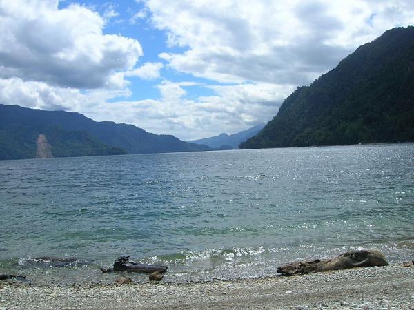
Chapo Lake (Spanish: Lago Chapo) is a lake of Chile located in Los Lagos Region. It lies immediately southeast of Calbuco volcano and south of Llanquihue National Reserve. Just south of the lake is Alerce Andino National Park.
Its waters are used for hydroelectric power generation, which causes variations in the level of the lake.
Reloncaví Estuary receives the outflow of Chapo lake.
Its waters are used for hydroelectric power generation, which causes variations in the level of the lake.
Reloncaví Estuary receives the outflow of Chapo lake.
Wikipedia article: http://en.wikipedia.org/wiki/Chapo_Lake
Nearby cities:
Coordinates: 41°27'41"S 72°29'53"W
- Lake Llanquihue 72 km
- Amutui Quimey reservoir 162 km
- Musters Lake 489 km
- Colhué Huapi Lake 511 km
- Buenos Aires Lake (Argentina) / General Carrera Lake (Chile) 538 km
- Presidente Ríos Lake 560 km
- Cochrane Lake (Chile) / Pueyrredón Lake (Argentina) 633 km
- Petrified Forests Natural Monument 751 km
- Desagüe Arm 771 km
- O'Higgins Lake (Chile) / San Martín Lake (Argentina) 772 km
- Alerce Andino National Park 12 km
- Calbuco (volcano) 17 km
- Fox Hill Bed and Breakfast 25 km
- Breast Reloncaví 40 km
Comments