The Stone Arch Bridge (Minneapolis, Minnesota)
USA /
Minnesota /
Minneapolis /
Minneapolis, Minnesota
World
/ USA
/ Minnesota
/ Minneapolis
World / United States / Minnesota
railway, bridge, railway bridge


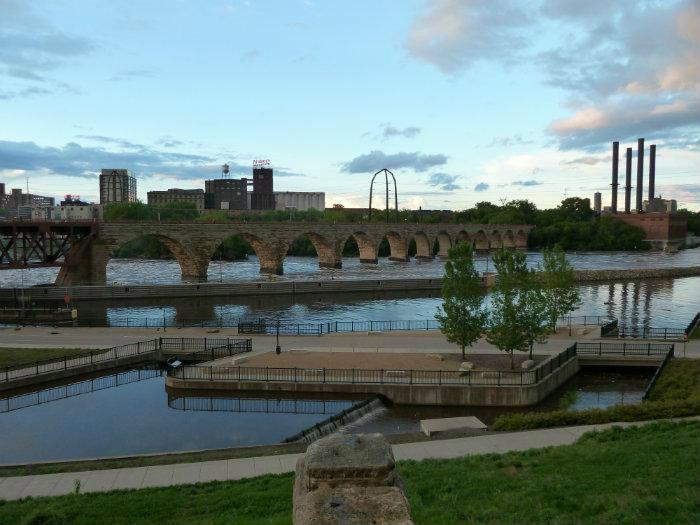


The James J. Hill Stone Arch Bridge opened in 1883 after 19 months of construction. This bridge was designed by Charles C. Smith and used St. Cloud granite for 23 spans and a length of 2,100 feet.
It was built by the Minneapolis Union Railway Company, which was owned by the St. Paul, Minneapolis and Manitoba. The St. Paul, Minneapolis and Manitoba became part of the Great Northern Railway, and eventually Burlington Northern. Amtrak's passenger trains used this crossing until February 28, 1978, while BN continued to use this bridge for coal traffic until 1980.
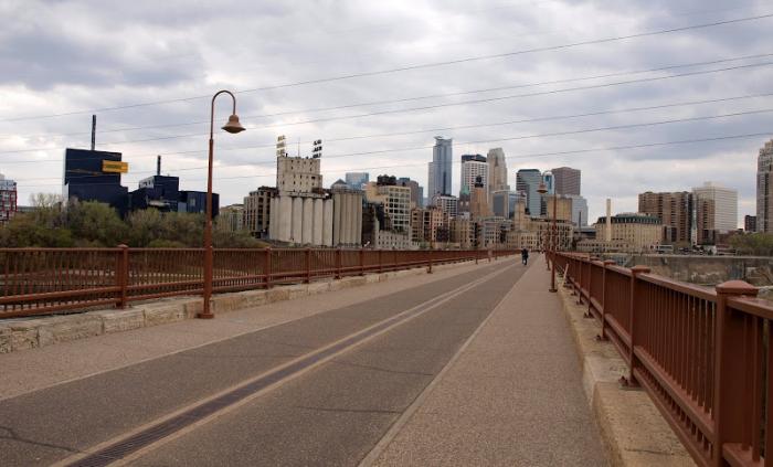
This curved stone & masonry bridge is an engineering feat, and a beautiful part of the Minneapolis waterfront. Now a pedestrian bridge between downtown Minneapolis and the Saint Anthony Main Street area.
Railroad bridges were built at 56 locations to cross the Mississippi River and 36 of these crossings are still in use by freight railroads.
It was built by the Minneapolis Union Railway Company, which was owned by the St. Paul, Minneapolis and Manitoba. The St. Paul, Minneapolis and Manitoba became part of the Great Northern Railway, and eventually Burlington Northern. Amtrak's passenger trains used this crossing until February 28, 1978, while BN continued to use this bridge for coal traffic until 1980.
This curved stone & masonry bridge is an engineering feat, and a beautiful part of the Minneapolis waterfront. Now a pedestrian bridge between downtown Minneapolis and the Saint Anthony Main Street area.
Railroad bridges were built at 56 locations to cross the Mississippi River and 36 of these crossings are still in use by freight railroads.
Wikipedia article: https://en.wikipedia.org/wiki/Stone_Arch_Bridge_(Minneapolis)
Nearby cities:
Coordinates: 44°58'50"N 93°15'17"W
- Minneapolis Diagonal Trail 4.5 km
- Canadian Pacific Shoreham Facility 5.2 km
- Former Milwaukee Road Bass Lake Yard 8.5 km
- CP Humboldt Yard 8.8 km
- BNSF Northtown Hump Yard 10 km
- CP Pig's Eye Yard 16 km
- BNSF Dayton's Bluff Yard 17 km
- Faribault, Minnesota 72 km
- Medford, MN 89 km
- Ellendale, MN 123 km
- Marcy-Holmes Neighborhood 1 km
- Downtown Minneapolis 1 km
- Elliot Park Neighborhood 1.2 km
- Downtown West Neighborhood 1.2 km
- Cedar-Riverside Neighborhood 1.5 km
- North Loop Neighborhood/Warehouse District 1.8 km
- Southeast Minneapolis 1.8 km
- Ventura Village Neighborhood 2 km
- Loring Park Neighborhood 2.2 km
- North Minneapolis 4.8 km
Comments