Walton Pier
United Kingdom /
England /
Frinton and Walton /
Pier Approach
World
/ United Kingdom
/ England
/ Frinton and Walton
World / United Kingdom / England
pier
Add category
Info: www.waltonpier.co.uk/
Photos:
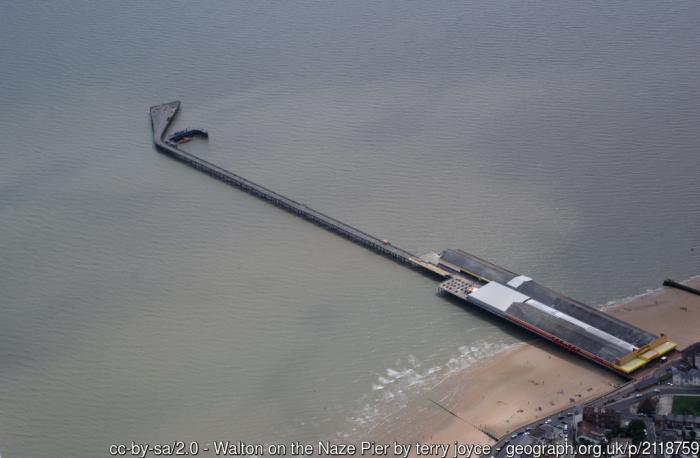
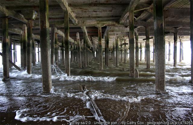
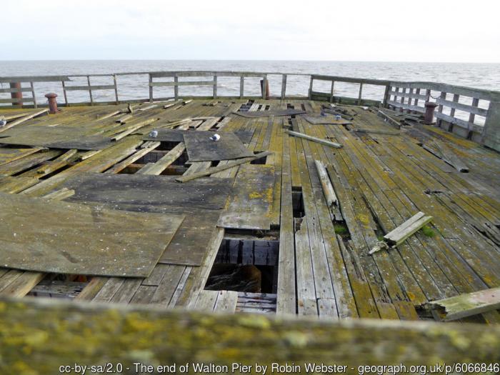
1) www.geograph.org.uk/photo/2118759
2) www.geograph.org.uk/photo/1479263
3) www.geograph.org.uk/photo/6066846
Photos:
1) www.geograph.org.uk/photo/2118759
2) www.geograph.org.uk/photo/1479263
3) www.geograph.org.uk/photo/6066846
Wikipedia article: http://en.wikipedia.org/wiki/Walton-on-the-Naze#Walton_Pier
Nearby cities:
Coordinates: 51°50'41"N 1°16'32"E
- Claction Pier 11 km
- Southend Pier 52 km
- The Prince of Wales Pier Dover UK 81 km
- Westerstaketsel 132 km
- Eastbourne Pier 138 km
- Scheveningen pier 208 km
- pier 233 km
- pier 234 km
- Pier Ameland 352 km
- Jade-Weser-Port 501 km
- Frinton Park Estate - There are a lot of Art Deco Houses in this area 1.4 km
- Recreation ground 1.9 km
- Titchmarsh Marina 2.4 km
- Water treatment plant 3.1 km
- The Wade 3.3 km
- Hamford Water National Nature Reserve 4.7 km
- Dovercourt Caravan Park 8.8 km
- Container Terminal Parkeston Quay & proposed Bathside Bay 11 km
- Harwich International Port Former Parkeston Quay 11 km
- Port of Felixstowe 13 km
Frinton Park Estate - There are a lot of Art Deco Houses in this area
Recreation ground
Titchmarsh Marina
Water treatment plant
The Wade
Hamford Water National Nature Reserve
Dovercourt Caravan Park
Container Terminal Parkeston Quay & proposed Bathside Bay
Harwich International Port Former Parkeston Quay
Port of Felixstowe