Seraglio Point (Sarayburnu) (Istanbul Metropolitan Municipality)
Turkey /
Istanbul /
Istanbul Metropolitan Municipality
World
/ Turkey
/ Istanbul
/ Istanbul
World / Turkey / Istanbul
park, cape (geography), neighbourhood development

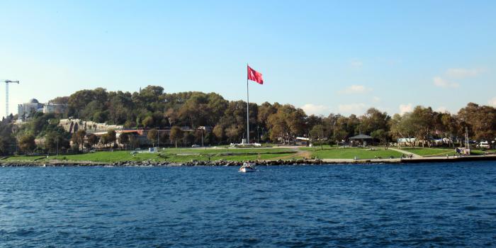
The promontory separating the Golden Horn and the Sea of Marmara in Istanbul. Sight of some of the oldest settlements in what is now Istanbul (stretching back to the at least the 13th Century BC). This is where the protective sea chain anchored (from Maiden's Tower, to the east) in order to keep ships from sailing through the Bosporus without paying a toll.
Wikipedia article: http://en.wikipedia.org/wiki/Sarayburnu
Nearby cities:
Coordinates: 41°0'57"N 28°59'4"E
- Cape of Limankoy 129 km
- Cape Kaliakra 267 km
- Ceatalul Ismail 471 km
- Cape Aja 539 km
- Cape Malyi Fontan 622 km
- Ai-Foka Cape 637 km
- Meganom Cape 651 km
- Kaldan Cape 668 km
- Fonar cape 788 km
- Red Lighthouse Cape 1014 km
- Hocapaşa 0.4 km
- Sirkeci 0.5 km
- Cankurtaran 0.6 km
- Eminönü 1.2 km
- Kılıçali Paşa 1.4 km
- Fatih (District) 2.6 km
- Beyoğlu (District) 3.4 km
- Bosphorus 13 km
- Istanbul Province 20 km
- Sea of Marmara 67 km