Hines Drive - Plymouth Riverside Shelter (Plymouth, Michigan)
USA /
Michigan /
Plymouth /
Plymouth, Michigan
World
/ USA
/ Michigan
/ Plymouth
World / United States / Ohio
road, park
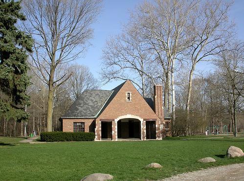
Hines Drive, a 17-mile long road/park that follows the path of the Rouge River from Dearborn to Northville.
Constructed in 1930, this comfort station with its large lobby entry area
was, like many other comfort stations, patterned after a train station.
People would gather in the glass enclosed sunroom for checker tournaments.
Although Wayne County was acquiring land for the Parkway as far back as the
early 1920s, the first mile of Hines Drive was actually built along the station
area in 1931. The desire to use the Plymouth Riverside Area encouraged the
Wayne County Road Commissioners, as Park Trustees, to develop a Master
Parkway Plan in 1928. Patterned like the Bronx Parkway Plan of New York,
this plan was very aggressive and proposed establishing parkways along every
major river course in the county.
Nearby cities:
Coordinates: 42°22'16"N 83°27'18"W
- 400-407 Interchange 355 km
- Heritage Drive, Montague Township 677 km
- Underwater Road 724 km
- South Mountain Road 793 km
- Grand Portage National Monument 802 km
- Interstate - 384 900 km
- Old Montauk Highway(Hither Hills-Montauk Beach) 961 km
- Km 275 - James Bay road at junction with The North Road 1114 km
- Km 544 - Junction of Trans-Taiga Road (east) & James-Bay Road (north) 1299 km
- Junction of Trans-Taiga Road & Laforge-2 Dam 1624 km
- Riverside Cemetery 0.3 km
- Old Village 1 km
- Wilcox Lake 1.5 km
- Plymouth Diamond 1.5 km
- West Middle School 2.2 km
- Plymouth Square Condominiums 2.3 km
- M-14 Exit 20: Sheldon Road 2.4 km
- Plymouth Township, Michigan 2.9 km
- The Inn at St John's Center 2.9 km
- Troy Design & Manufacturing 3.1 km