Lop Nur
China /
Xinjiang /
Hami /
World
/ China
/ Xinjiang
/ Hami
World / People's Republic of China / Xinjiang Uygur / Bayin'gholin Mongol
dry lake
Add category
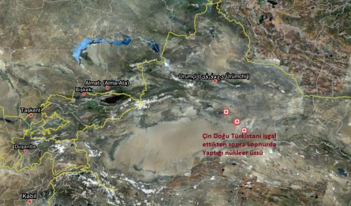

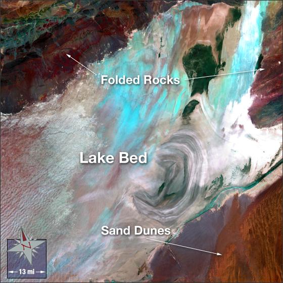
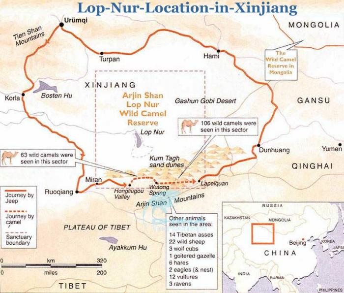
Located in the northeast of Ruoqiang County, Lop Nur is about 780 meters (2,560 feet) above sea level and covers an area of about 3,000 square kilometers (1,160 square miles). Once it was the second largest inland lake in China and an important station on the Silk Road. Due to its geological features, Lop Nur has had many names over the centuries - Salt Lake, Puchang Sea and Peacock Sea among them. Since the Yuan Dynasty (1271-1368), it has been called Lop Nur. In Uygur, 'Lop' means a place having a vast expanse of water. In Mongolian, 'Nur' refers to a lake. 'Lop' and 'Nur' together means a vast lake. However, it dried up in 1972 because of excessive human economic activities in the area.
Wikipedia article: http://en.wikipedia.org/wiki/Lop_Nur
Nearby cities:
Coordinates: 40°8'33"N 90°30'30"E
- Lake Tapawuga 903 km
- Two small lakes 3184 km
- un-named lake 3189 km
- East Baray 3245 km
- Indratataka 3259 km
- Suarez Mountain Dry Lake 4880 km
- Tower 6.6 km
- Lop Nur Phosphate and Potash Mine 38 km
- Power station 46 km
- Potash Plant 47 km
- Bridge 63 km
- Pumping station 63 km
- Ancient fortress ruin 65 km
- Rock 71 km
- Ruin of Tuyin 75 km
- Settlement 157 km
Comments