Cordillera Real
Bolivia /
La Paz /
Achacachi /
World
/ Bolivia
/ La Paz
/ Achacachi
World / Bolivia / La Paz / Pedro Domingo Murillo
draw only border, mountain range
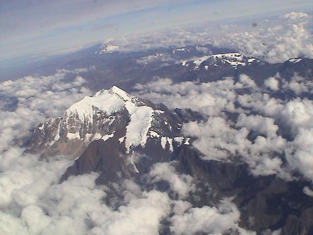

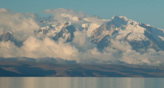
The Cordillera Real is a mountain range in the South American Altiplano of Bolivia. This range of fold mountains, largely composed of granite, is located southeast of Lake Titicaca, and east of the Bolivian capital of La Paz, measuring 125 km in length and 20 km in width.[1] Despite the fact that it is only 17° south of the Equator, the Cordillera Real is relatively densely glaciated. This is due to its proximity to the Amazon lowlands with its associated moist air masses.
Wikipedia article: http://en.wikipedia.org/wiki/Cordillera_Real_(Bolivia)
Nearby cities:
Coordinates: 16°10'17"S 68°9'41"W
- Cordillera Kimsa Cruz 87 km
- Cordillera Apolobamba 234 km
- Vinicunca (Rainbow Mountain) 430 km
- Cordillera Vilcanota 448 km
- Torres del Paine Park 3887 km
- Wickham Heights 4033 km
- Tangra Mountains 5205 km
- Desko Mountains 5955 km
- Staccato Peaks 6180 km
- Diggles Creative 8502 km
- Huayna Potosì 10 km
- Maria Lloco 11 km
- Chacaltaya (5,421 meters) 12 km
- Huayna Potosí High Camp "Anselme Baud" 12 km
- Nevado Charquini 16 km
- Cotapata Nacional Park (and ANMI) 26 km
- Death Road [Bolivia Road of Death] 34 km