Wakefield
USA /
New York /
Mount Vernon /
World
/ USA
/ New York
/ Mount Vernon
World / United States / New York
neighbourhood, draw only border, residential neighbourhood
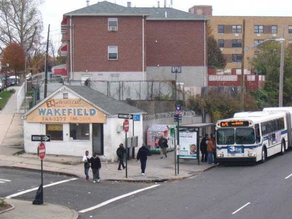


Wakefield is a residential and middle-class section of the northern borough of the Bronx in New York City, bounded by the New York city line with Westchester County to the north, 222nd Street to the south, and the Bronx River, Bronx River Parkway and Metro-North Railroad tracks to the west. Wakefield is the northernmost neighborhood in New York City (although the city's northernmost point is actually in Riverdale, at the College of Mount Saint Vincent). The neighborhood is part of Bronx Community Board 12. The United States Census, 2000 reported a total of 67,787 residents.
Formerly, Wakefield was home to large Irish American and Italian-American populations. During the 1980s, those communities being replaced with significantly large African American and West Indian populations, which now comprise 72.3% of the neighborhood's total population. The neighborhood is home to many prominent Catholic secondary schools including the all-male Mount Saint Michael Academy, which serves 1,100 students on grades 7-12.
The Wakefield Metro-North Railroad station on the Harlem Line is located at 241st Street. The neighborhood is served by the IRT White Plains Road Line (2 5) of the New York City Subway. The neighborhood's ZIP Code is 10466.
Wikipedia article: http://en.wikipedia.org/wiki/Wakefield,_Bronx
Nearby cities:
Coordinates: 40°53'46"N 73°51'8"W
- Harlem (Manhattan, NY) 11 km
- Astoria 14 km
- Sunnyside 18 km
- Greenpoint 20 km
- Williamsburg 21 km
- Bushwick 22 km
- Stuyvesant Heights 23 km
- East New York 23 km
- Canarsie 27 km
- Bensonhurst 32 km
- Wakefield Park 1.9 km
- Woodlawn Cemetery 1.9 km
- Northeast Forest 2.2 km
- Van Cortlandt Park 2.7 km
- Kimball 2.9 km
- Bronx Park 3.5 km
- Pelham Bay Park 5.1 km
- The Bronx 5.2 km
- Westchester County, New York 27 km
- Long Island Sound 65 km
Comments