Kozachy
Ukraine /
Mykolayivska /
Ochakiv /
World
/ Ukraine
/ Mykolayivska
/ Ochakiv
, 5 km vom Zentrum (Очаків)
Världen / Ukraine / Oblast de Mikolaiv
Künstliche Insel
Kategorie hinzufügen
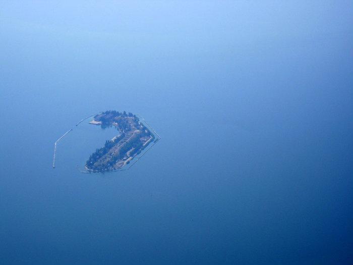
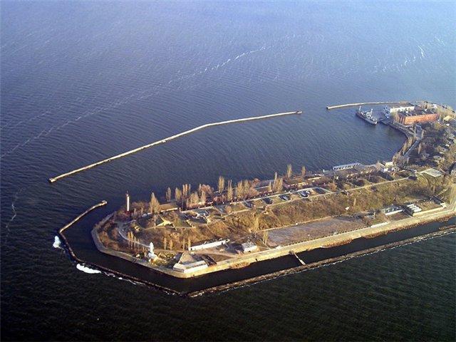
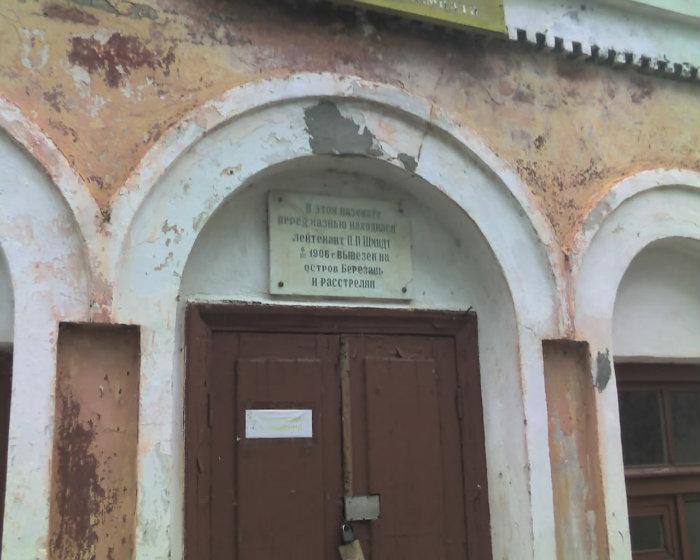
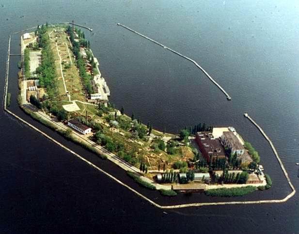
Früher als Insel Perwomajskyj bekannt.
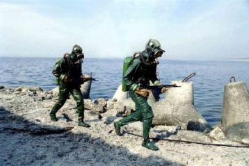
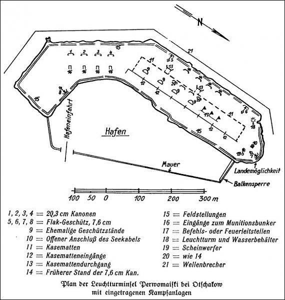
1895 fertiggestellte, künstlich angelegte Insel, 700 Meter lang, 140 Meter breit, Umfang 1250 Meter, lange Zeit Militärbasis von sowjetischen und später ukrainischen Marineinfanteristen (Морские котики, Navy SEALs) der Schwarzmeerflotte
1895 fertiggestellte, künstlich angelegte Insel, 700 Meter lang, 140 Meter breit, Umfang 1250 Meter, lange Zeit Militärbasis von sowjetischen und später ukrainischen Marineinfanteristen (Морские котики, Navy SEALs) der Schwarzmeerflotte
Wikipedia-Artikel: http://de.wikipedia.org/wiki/Perwomajskyj_(Insel)
Nearby cities:
Koordinaten: 46°34'19"N 31°33'36"E
- Sprogø 1734 km
- Minsener Oog 1851 km
- Insel 1885 km
- Insel 1885 km
- Insel 1886 km
- The Palm Jumeirah 3170 km
- Flughafen Hong Kong "Chek Lap Kok" (HKG) 7665 km
- Flughafen Kansai 8227 km
- Huayang Jiao 8636 km
- Rajon Otschakiw 11 km
- Dnepr-Bug-Liman 31 km
Kommentare